Friday, December 7, 2012

Saint Paul Union Depot reopening tomorrow

saint-paul-union-depot-1923
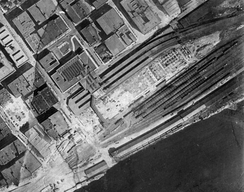
An aerial view of the Saint Paul Union Depot under construction in 1923.

After laying dormant for 41 years, the concourse and waiting room of the Saint Paul Union Depot will reopen to the public tomorrow, Saturday, December 8th. The reopening comes after a two-year, $243 million rehabilitation of the massive building and the 33-acre site it occupies, which included $148 million in construction and renovation plus $95 million for property acquisition, environmental remediation, and other work.

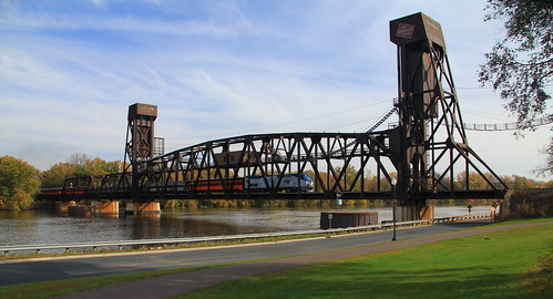
The Union Depot building itself is divided into three pieces: the headhouse, which sits between 4th Street and Kellogg Boulevard, the concourse, which crosses over Kellogg, and the waiting room, which extends farther south toward the Mississippi River.  (The waiting room is missing from the aerial shot above, but the headhouse and concourse are visible.)  The concourse and waiting room connected passengers to a massive train deck below, which raised the tracks and platforms about one story above ground level (a good way to keep tracks dry considering the Mississippi's frequent floods).

While the headhouse has largely remained open to the public ever since the depot first opened, the rear of the building was closed off in the 1970s.  When Amtrak was formed in 1971, railroad operations in the Twin Cities were consolidated into the Great Northern Depot in Minneapolis, though that was demolished in 1978 after Amtrak moved operations to the current Midway station in an industrial area on the west end of Saint Paul.  Tracks remained in place behind the Union Depot for several years, but were ripped out in the late 1970s when the U.S. Postal Service acquired the concourse, waiting room, and train deck below.

The USPS built skyways to a new structure on the train deck which was used as a semi-trailer truck loading dock.  In order for trucks to access the loading dock, a ramp was sliced right through the train deck at Broadway Street, making it impossible to restore train tracks until the gap was filled.  Much of the deck area was also converted into parking lots.  With only minimal maintenance, the building and deck deteriorated over time, with peeling paint inside and rusting metal and crumbling concrete outdoors.  It took on the aura of an abandoned industrial zone, seemingly too expensive to tear down, so it just became covered in asphalt and forgotten about.

The building did receive some attention over the years, particularly the headhouse which had gone through some cleanup and remodeling.  39 condominium units were added in the early 2000s to the upper floor circling around the west, south, and east sides.  However, the true extent of the accumulated grime wasn't clear until the headhouse was cleaned up in 2011—Interior columns that had seemed to have a glossy gray color turned out to be a matte pink once the layered soot and grease was removed.

A concrete pedestal that had once displayed the William Crooks locomotive was removed in the renovation.  It had been disguised as the Christos restaurant seating area for many years.  While some railfans lamented the fact that the first steam engine to operate in Minnesota won't return to its old display location (it's now up in Duluth), the removal of the concrete pad made the Great Hall area a much more flexible space.

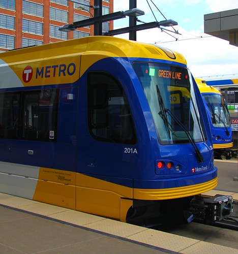
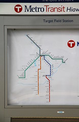
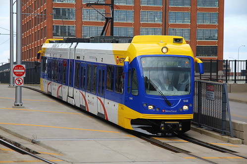
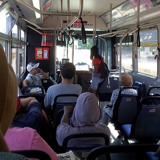
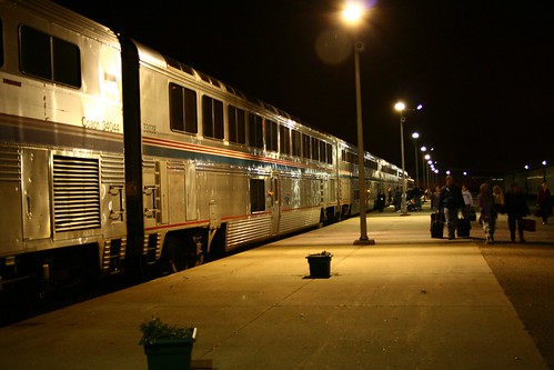
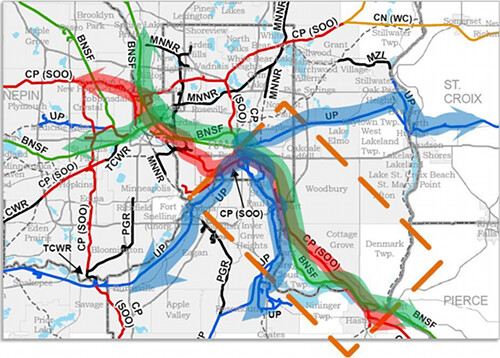
While the Great Hall reopened to the public at the end of 2011, renovations continued elsewhere in the building, and new structures were also added.  Amtrak is not yet able to move from Midway station to the Union Depot because it has taken a long time to schedule the necessary track work to connect the new rail platform to Union Pacific and Canadian Pacific tracks that pass nearby, but Metro Transit bus service will begin at the depot tomorrow, followed in a month or so by Jefferson Lines.

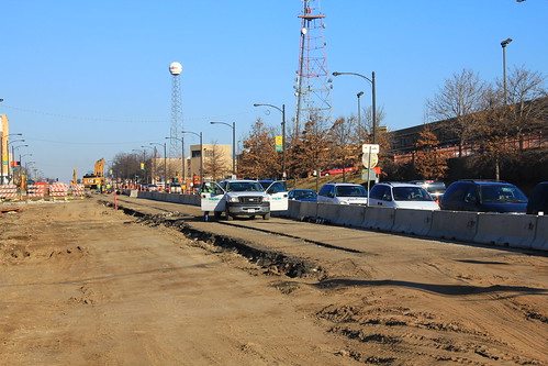
The huge train deck has been slightly reduced in size to make room for wider sidewalks along Kellogg Boulevard and Sibley Street, and a bike path has been built to ride along the northern edge of the deck area (whether it connects to anything yet is unclear—the U.S. 52/Lafayette Freeway Bridge construction zone to the east may prevent it from going anywhere for a while).

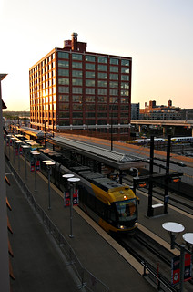
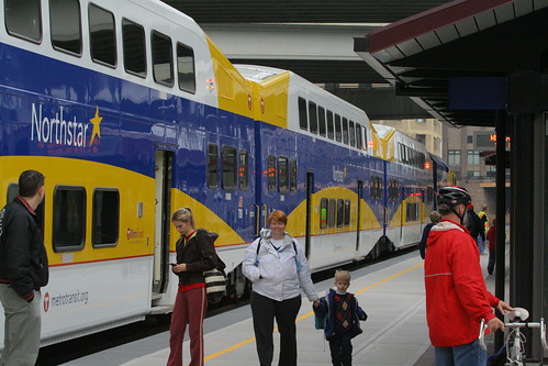
At its peak around the time it opened, the Union Depot saw hundreds of trains each day.  Many of these were local commuter services, a role that has been supplanted by buses today.  A portion of the train deck has been dedicated to use by local, commuter, and intercity buses, while the platform Amtrak intends to use is at the southern end, closest to the Mississippi River.  The ramp that the USPS sliced into the train deck has been rebuilt with a roughly right-angle turn to take buses up to this new transit center, making room for a few tracks to be restored.

In terms of tracks and platforms, the historic station was on par with the current capacity of Penn Station in New York City (which handles 15 times as many passengers daily as the Union Depot did at its peak), so it was oversized from the beginning.  Unfortunately, construction of the depot wrapped up right as passenger train travel was peaking in the United States.  There had been even grander visions, and at one point prior to completion, there was even talk of diverting the Mississippi to make way for additional tracks and platforms.  At least the planners of the day didn't go that far overboard.

It would be a surprise if the depot ever again sees as many train passengers each day as it did in the 1920s, so a multi-modal approach is critical to bringing in enough traffic to keep the building active.  Finding ways to use the depot as a public space with community events will also be essential, and hopefully some retail businesses will also be able to carve out their own spaces and find success as the structure revives.  The surrounding Lowertown neighborhood has turned into one of the densest neighborhoods in the Twin Cities.  While it will take a few months longer for actual trains to arrive, and years more before faster and more frequent service arrives, hopefully the return of a long-lost space will help the area continue on its upward trajectory.

Friday, November 9, 2012

Better balance in transportation possible as legislature swings to DFL

Minnesota State Capitol

Just two years after the Minnesota State Senate and House of Representatives came under Republican control in the Tea Party wave of 2010, both houses flipped back to Democratic-Farmer-Labor majorities in the election this past Tuesday. This was a big surprise to local news outlets, who had expected Republicans to retain the upper hand. The state has had a string of Republican and third-party governors in recent decades, so this marks the first time since 1990—the Rudy Perpich administration—that the governor and the leadership in both chambers have been in DFL hands.

I won't try to decode what was going through voters' minds on Election Day, but this had certainly been the least popular legislature in memory: The public blamed them for the 2011 state government shutdown by a 2–1 margin over Governor Mark Dayton, and approval of the legislature dipped to 17% in February this year. Perhaps buoyed by the turnout against two constitutional amendments that grabbed serious attention, the electorate created a Democratic wave just as big as the one that brought many Tea Party-infused candidates into position just one cycle ago.


The change in Saint Paul, as well as shifts in power nationally, should lead to better outcomes for advocates of balanced transportation including infrastructure for walking, biking, transit and trains to complement our current system heavily biased toward auto and air travel.  This past legislature had reduced funding for or declined to fund projects including the Southwest LRT line from Minneapolis to Eden Prairie (now known as the "Green Line Extension") and the Northern Lights Express intercity train from Minneapolis to Duluth.  They had also reduced the biennial allocation of funding to Twin Cities-area public transit by 46%, slashing annual state support from $72 million to $39 million.

Oddly, that particular legislation included guidance for the following biennium to restore most, but not all, of that particular pot of money—perhaps someone knew their moment in the sun was fleeting.

Rep. Michael Beard (RShakopee) in particular caused infuriation for transit advocates in his role as chairman of the House Transportation Committee, particularly after proposing drastic cuts and making comments indicating he viewed public transit primarily as a social service for people of little means rather than a legitimate transportation alternative for the public at large. (Surprisingly, despite the anti-train record, Rep. Beard has been known to take rail excursions such as those offered by the Friends of the 261, though I don't know if he's taken them of his own accord or was invited along by rail advocates.)

Mr. Beard easily retained his seat in this year's election, but will no longer hold the chairmanship of the Transportation Committee. Other seats along the Southwest LRT corridor did flip to DFL hands, however. Up north, Chip Cravaack lost his U.S. House seat from the 8th District which includes Duluth, being replaced by Rick Nolan, a former congressman. Cravaack was opposed to the Northern Lights Express train service, but Nolan appears to support it (though his campaign website specifically calls out "high-speed light-rail"... Oh dear).

Another major rail project that stalled in 2010 was the high-speed extension of Amtrak's ChicagoMilwaukee Hiawatha Service to Madison, Wisconsin, which probably would have been extended to the Twin Cities a few years later.  Curiously, while Minnesota's government went all blue in the general election, Wisconsin's capitol returned to red as the slim 1-vote Democratic majority in their State Senate (due to recall elections in 2011 and 2012) was washed away.  With a governor whose campaign drew upon and fueled ire against the Madison extension, it seems unlikely that there will be significant movement on this front beyond the current effort to run a second daily train on the route of Amtrak's Empire Builder.

Similarly, the political winds didn't shift quite as much in Washington as they did here, so funding from the federal government may continue to slow down. Democratic candidates for the U.S. Senate largely ran the table, but the power shift was much less pronounced in the U.S. House, where the GOP remains in charge.

Will either the U.S. House or the Wisconsin Legislature become more moderate this time around? I can't say. Hurricane Sandy has been used to focus attention on climate change, and we need to restructure our land use, transportation networks, and utility networks to deal with that. Rising oceans wouldn't seem to affect Wisconsin much, but the storm was big enough to whip up big waves on Lake Michigan. We've had some big storms in the Midwest as well, such as the one that caused massive flooding in Duluth this past June. Perhaps outside events like these will help shift some opinions on a variety of transportation projects.

Friday, October 26, 2012

When the humble bus stop is a little too humble


View Larger Map

This is the busiest transit stop in the state of Minnesota, seeing about 4,300 boardings daily, though you'd never know it by looking. It's on the south side of City Center on 7th Street and Nicollet Mall in Minneapolis, and lacks most of the amenities you'd expect to find at a location with that volume: Shelters to provide cooling shade in the summer and heaters in the winter, as well as rain, snow and wind. There is a little seating, but not much. Good lighting, signage, and information kiosks are practically nonexistent.

Less obvious in photographs is the simple lack of space. The sidewalk has frequently been getting filled up with bus patrons, leading Metro Transit to add some markings to the pavement to delineate the areas where bus passengers should stand to separate them from the flow of pedestrians.


Um... Great?

As part of a campaign dubbed "WalkSafe", the benches (mostly obscured in this photo from Metro Transit, but still barely visible in the distance) have been moved away from the wall of City Center, and some brightly-colored stickers have been added. A NexTrip sign indicating bus arrival times has also been added, but it's tucked away in a spot that's hard to see. Sure, some people will go along with the new separation of space, but this arrangement is uncomfortable for others who prefer to hug the side of the building in order to grab what little shelter they can, and simply to take a load off by leaning up against the wall. Unfortunately, the sidewalk is already crowded, so attempting to add shelters, benches, or other street furniture would only make it harder to move through the area.

There should be other options, including expanding the sidewalk area. While it might be possible to carve a space out of City Center, the better option is probably to add a bulb-out to extend the sidewalk area into the street. 7th Street is a one-way with three lanes for through traffic plus curb lanes on each side. The street could handle moving the buses into the right-most through lane and extending the sidewalk into the right-hand curb lane, more than doubling the room in the waiting area.  That would open up a huge range of possibilities for good designs that will pull those stragglers away from the wall of City Center.

Extensions like that have cost up to around $60,000 in other cities, including new shelters—this stop probably generates that much in fare revenue every 2–3 weeks. With a pace like that, there's a clear benefit to making a real investment in this stop to change it into a place where riders can feel like they're human rather than trash to be shoved out of the way. Believing that this site can be improved by simply moving the existing pieces around is patently ridiculous.

Wednesday, October 24, 2012

Update on Amtrak derailment in Niles, MI

The National Transportation Safety Board gave an update yesterday (Tuesday, Oct. 23) on the derailment of Amtrak Wolverine #350 this past Sunday, where the train hit a misaligned switch, sending it off the mainline and into a small rail yard. From this Chicago Tribune report and this Detroit News report, we get the following details:
  • The train had a green signal prior to hitting the switch.
  • The train hit the switch at about 60 mph. The jolt knocked the engineer to the floor, but he was able to hit the emergency brake.
  • There was a derail device on the track to the yard, but it did not have any effect on the fast, heavy train locomotive. The train ultimately derailed 290 feet beyond the switch.
  • The train came to a stop 21 feet away from empty hopper cars (for carrying ballast) that were parked in the yard.

As I mentioned in my previous post, this line is supposed to have Positive Train Control signaling installed to prevent dangerous situations like this from happening. The details thus far reinforce my belief that the switch involved was simply not wired into the signaling system, since a "reversed" switch would have changed the signal to either a stop or some other indication telling the engineer that the train could only proceed at low speed. But, other possibilities remain, such as an improper design to the PTC hardware or software, a fault that went undetected, or even a broken switch that failed just as the train went over it.

Tuesday, October 23, 2012

Amtrak derailment in Niles, MI appears to show weakness in Positive Train Control

This past Sunday, October 21st, an eastbound Amtrak Wolverine train from Chicago to Detroit/Pontiac derailed just outside Niles, Michigan, shortly after leaving the station there. While most news outlets have simply reported the derailment and the modest number of minor injuries that resulted, the Detroit Free Press noted in its reporting that the train ended up on the wrong track.


View Amtrak derailment, Niles, MI 2012-10-21 in a larger map

The mainline here only has a single track, so the "wrong track" appears to be a spur into an old yard area adjacent to the mainline. There is a siding right in Niles so that trains can pass each other at the station. Heading east, the line narrows back down to a single track about 1.3 miles out. Immediately after becoming single-tracked, there's another switch that leads off to the aforementioned yard area. According to Google Maps imagery, this is the only spot where it's possible to leave the mainline until another siding appears in Dowagiac, 12 miles away from Niles.

The track in this area is able to carry trains at speeds up to 110 mph in part because it has a Positive Train Control (PTC) system installed (specifically GE Transportation Systems's Incremental Train Control System, or ITCS) which is supposed to improve safety by preventing collisions between trains. Unfortunately, it looks like that system failed in some way, and disaster was probably only averted through the use of a very simple device actually known as a derail—a wedge-like hunk of metal that is locked onto a rail with the express purpose of derailing anything that rolls over it. This is generally used to prevent parked rail cars from accidentally rolling out of a yard or spur track and onto the mainline, but (as happened in this case) can also prevent a train inadvertently coming off the mainline from slamming into parked rail cars at full speed.

In fact, a derail device can be seen on another track in this shot of the derailment from the Associated Press. The mainline appears to be the track way off on the left, partially obscured by the orangish freight cars, while the derail appears below them (in the foreground):


The National Transportation Safety Board (NTSB) is investigating this incident. Hopefully they will have an initial report coming on it soon, though their full investigations typically take a year to 18 months. The NTSB has been recommending PTC be installed on rail lines for many years now, so it will be interesting to see how they react to an incident in a zone where it is apparently in use. Perhaps this specific spot didn't have it. My gut is leaning toward the idea that the switch that led off to this spur was intentionally not included in the PTC signaling system. Is it a manually-thrown switch, or is it controlled remotely? Amtrak actually owns the mainline here, and dispatching is their responsibility. If the switch is remotely controlled, then the dispatcher out on the east coast probably screwed up.

It'll also be interesting to learn how fast the train was going when it entered the spur and when it (presumably) hit the derail, and when or whether the brakes were being applied. If the signals were all working correctly and the switch off into this yard area is actually wired into the signaling system, the train probably should have had a "stop" signal just west of the misaligned switch—either the engineer should have stopped there because of the signals he/she saw in the cab and/or in the signal heads adjacent to the track, or the PTC system should have automatically stopped the train.

However, there's a decent possibility that the expected outcome here would have been for a train to get a signal telling the engineer and PTC system that it could proceed at a slow speed into the yard (probably 30 mph at most, and likely less than that). But, looking at pictures of the derailment, it seems to me that the train was going much faster than 30 mph when it hit the either derail device or a warped-enough piece of track to cause it to start sliding along the ground. (That said, there's an incredible mass there, and my imagination may not handle it properly. I also don't know exactly where the derailment began.)

One complexity thrown into the mix here is that a train traveling between two points has a very different method of operation from a train working in a yard. Out on a mainline, two trains should never really occupy the same stretch of track, but yards, spurs, and sidings often involve partially-assembled trains shoving things around, attaching and detaching themselves to or from other train segments. In theory, the PTC system probably should have known that the Amtrak train is a passenger train and had no business going into a freight spur.

There's a possibility that the switch leading off the mainline actually broke either as the Amtrak train went through it or shortly before, but that seems pretty unlikely based on where the train ended up: The train probably would have derailed as it passed over the mainline switch, rather than managing to continue a couple train lengths beyond. Some of the train—particularly the lead locomotive—probably also would have continued forward along the mainline in that event. Stranger things have happened, though.

This line is really one of the primary test beds for PTC implementation around the country: Amtrak first installed ITCS in 2002 to test it out, and speeds have been raised progressively over the last decade. Starting out at 79 mph in 2002, the limit went up to 95 mph in 2005, and Amtrak trains finally began operating regularly at 110 mph in February 2012.

The derailment came just two days after Amtrak made their first 110-mph test run along the Chicago to St. Louis corridor, also enabled through the use of ITCS PTC. That line is owned by Union Pacific and has historically had a cab signaling system in place to prevent train collisions. The cab signaling system might have acted as a fallback if a similar situation occurred in Illinois, but it's not clear to me if the newer PTC system would override that or not.

Speaking as someone who wants to see passenger trains deployed much more broadly across the U.S. and operating at higher speeds to be more competitive with car and air travel, this is extremely frustrating. It really looks like someone did a half-assed job either in designing the underlying signaling technology, or at least in their implementation of it it on this line. For all that has been written about the problems leading up to that high-speed train crash in China last year, our signaling systems in the U.S. are generally far less able to prevent accidents than the system in use there. PTC is supposed to make things much safer, but it failed to do its job on Sunday.

[Edit: Please take a look at my update to this story.]

Friday, October 12, 2012

New light-rail vehicles bring a fresh look to Twin Cities transit

img_6156
A new Siemens S70 parked at Target Field alongside a Bombardier Flexity Swift in new "METRO" paint.

Metro Transit officially unveiled their first new Siemens-built light-rail vehicle on Wednesday, previewing what most of the Twin Cities light-rail fleet will look like just a few years from now.  It also marked the first showing of vehicles with the new "METRO" branding which will be used on light rail and bus rapid transit lines going forward.  Both the new Siemens LRV and one of the original Bombardier LRVs showed up in a brighter paint scheme of yellow, blue, and light gray, but still following the general pattern established by the older units when they began service on the Hiawatha Line in 2004.

img_6131-adjust
By now you may have heard the "Green Line" moniker that has been attached to the Central Corridor LRT project, and that the Hiawatha Line will soon be known as the "Blue Line".  The Southwest LRT project is now being called the "Green Line extension", and the Cedar Avenue and Interstate 35W BRT services are planned to be known as the Red and Orange lines, respectively.

Those routes are going to be unified under the "METRO" name.  This seems like an attempt to keep everyone thoroughly confused, though it does have a purpose: At least one of the BRT lines will be operated by the Minnesota Valley Transit Authority.  The METRO system will represent a unified brand across two different agencies and service regions.  It's an interesting political tool, but will any riders actually notice?  We'll have to wait and see.

The new branding has been rolling out slowly and has been most noticeable up until now along the Green Line where information kiosks at new stations have incorporated the METRO name.  While the train that rolled in to Target Field this week was described as "the first Green Line car", it will first see revenue service on the Blue Line.  This first car actually arrived in the Twin Cities last month and has been undergoing some initial testing.  Along with a second vehicle that arrived this week, the pair will be tested extensively, with overnight runs in the tunnels under MSP airport, before going into service around January.  Later arrivals will probably only need about one month of testing each before being officially accepted into the fleet by Metro Transit.

59 vehicles are currently on order for the Blue and Green lines, and there are options in the contract for 40 more.  The Hiawatha Line had 24 Bombardier LRVs operating by the end of 2004, but the line's ridership blew away expectations and Metro Transit ended up operating more trains and longer trains than anyone had anticipated.  They were able to exercise options for 3 additional vehicles a couple of years later, but that was the maximum allowed in the contract.  After those three were completed, Bombardier shut down the Flexity Swift manufacturing line for good, and Metro Transit has been making do with an undersized fleet for several years now.

12 of the new trains will go toward beefing up the Blue Line fleet, while the remaining 47 in the order are intended for the Green Line to Saint Paul.  Most or all of the last 40 options will probably be picked up once the Southwest extension gets approved for funding.

Metro Transit has been preparing for quite a while to receive the new trains.  The Franklin Avenue shops have been undergoing an expansion for the past year to make room for the new vehicles, and some operations that don't require direct access to the train chassis have been moved into a new Light Rail Support Facility about half a mile south.  Some vehicles officially intended for the Green Line may have a temporary home by Franklin Avenue until the new maintenance facility in Lowertown Saint Paul becomes complete enough to receive the new trains.

The new trains have some improved features as well as reduced weight compared to their older counterparts.  The older Bombardiers weighed in at 53 tons each, while the newer Siemens model is only 50.  That reduction by 6,000 pounds should help with overall efficiency and reduce electricity consumption, though it falls short of what could be achieved.  The Bombardier Flexity Swift model was primarily sold in Europe, and Metro Transit turned out to be the only American buyer.  The LRVs on the other side of the Atlantic only weighed in at 41 tons.  Federal regulations for crash requirements appear to be the culprit in porking out our original fleet as well as the newer vehicles, increasing energy consumption and adding extra wear and tear to the rails—and, of course, having the perverse effect of making it harder to absorb the energy of a crash in the first place.

The new Siemens S70 trains are a bit boxier than their elders in the fleet, which isn't to everyone's liking.  However, they have been made a bit sleeker through the removal of rear-view mirrors, replaced by rear-facing video cameras with displays inside the cab.

img_6177 img_6182

The interior features light gray surfaces rather than the Bombardiers' yellow walls. The new trains have 68 seats rather than 66 in the Bombardiers.  The seating arrangement has changed a bit, with seats up on the high-floor sections above the driving wheels facing toward the middle section of the vehicle, rather than the face-to-face seating found in the Type 1 cars. There is some face-to-face seating in the enlarged middle section of the Type 2 cars, though.

img_6183-rotate
img_6155

The new trains also have a beefier heating system than the Bombardiers, and the unit on display this week was actively pumping out heat as the media and other onlookers gathered to check out the first article on a fairly cool and blustery day.  Improved insulation should help keep the interior warmer and quieter than older trains as well.

But I shouldn't forget to mention the Bombardier train painted in new colors which was also displayed on Wednesday.  These trains will probably still be with us for another 20 years, and it was good to see them getting spiffed up with a new paint job.  While I think the old paint scheme had aged relatively well, some trains have begun to look quite dirty despite getting washed on a regular basis.  The old paint has been physically aging, and deserves a refresh.

img_6186

Friday, September 28, 2012

Metro Transit tweaks planned Central Corridor bus routes

Map of recommended bus routes to be implemented once the Green Line (Central Corridor) begins operation in 2014.

In preparation for the opening of Green Line light rail 2014, Metro Transit has been busy over planning out how to rearrange connecting bus routes. Since the light-rail line will take over as the primary service in between downtowns of Minneapolis and Saint Paul, operator hours currently dedicated to bus routes 16, 50, 94 will be freed up and redistributed to other lines in the system.

An initial plan was released back in June and presented at some open house meetings and made available online. 650 people and organizations submitted 800 comments to Metro Transit, and they say the feedback was mostly positive. Several routes in the Central Corridor area will see higher frequency service and expanded service hours, including new weekend service in some cases.

Two hot topics were the addition/restoration of a route 83 bus on Lexington Parkway and the frequency reduction on the route 94 express bus which links the downtowns of Minneapolis and Saint Paul.

Route 83
Route 83 generated 176 comments—22% of the total—and was a mix of positive and negative. A route 83 bus had been tried on Lexington about a decade ago, but hadn't generated enough traffic at the time to continue operating. Metro Transit was revisiting the idea since Lexington Parkway is in the middle of a 2-mile gap between the 84 on Snelling Avenue and the 65 on Dale Street.

The June version of the plan had the route 83 bus running north only to Energy Park Drive to reach Snelling Avenue before finally terminating at Snelling and Como Avenue. One major reason not to continue farther north on Lexington is the BNSF Railway bridge just north of Energy Park Drive: it has low vertical clearance and requires low-slung buses to have a safe operation.

However, the community around Como Park pushed heavily to have the route extended farther north, and it appears their wish has been granted. Route 83 is now planned to run north to Horton Avenue and then loop around the western edge of the park on Hamline before running east to the intersection of Lexington and Larpenteur Avenue.

Near the south end of the route, the idea of a new bus line was much less popular. The bus is now planned to detour away from Lexington at Jefferson Avenue, make a modest zig-zag, and enter Interstate 35E from Randolph Avenue to make the short hop to West 7th Street.

Hopefully the new version of this route will be successful and stick around longer than the last shot at it did.

Route 94
Route 94 service received 85 comments, or just over 10% of the total. There was a lot of concern over the initially planned reduction in service, which would have brought the 94 down to just "expanded peak" hours, with service going away entirely during midday hours on weekdays. Route 94 is also planned to be reoriented to enter and leave downtown Saint Paul via the 5th Street ramps, bypassing the typical route used today which often loops around the State Capitol area and frequently runs past the Ravoux Hi-Rise on Marion Street.

Metro Transit has decided to continue running the 94 during midday hours on a half-hourly basis (down from a roughly 15-minute interval today). And to address the concerns of Ravoux residents, the route 16 bus will be rerouted to run along Marion Street rather than circling around the State Capitol grounds.

The June plan had suggested that route 94 buses skip the stop at Snelling Avenue, and that recommendation has been carried forward despite some requests to keep it. The drop-off stop in the middle of the Interstate 94/Huron Boulevard interchange will still be available, however.

As the original plan stated, route 16 will only run from downtown St. Paul to University & Oak Street on the UMN campus, and will not operate all the way into downtown Minneapolis (except late night). Transfer to UMN campus buses, Green Line, routes 2 and 6 to get to other locations.

Other routes
Some proposed changes to existing routes have been rolled back. The path of route 87 along University Avenue and across Interstate 94 had been put up for possible changes, but the revised plan retains the original routing. Since route 63 along Grand Avenue is now planned to be extended up Cretin Avenue to Raymond and University Avenues at its western end, there wasn't as much need to reroute the 87.

In general, bus routes in the Central Corridor area are going to have frequencies increased -- often bumping up from current intervals around 30 minutes down to 20 minutes. Some routes will do even better, such as route 84 along Snelling Avenue, which is still planned to bump up to to 10-minute service along the bulk of the route compared to the 15-minute cycle today.

I'm happy to see that Metro Transit officials did take heed of many of the comments from riders in the corridor area. I felt it was a good plan to start out with, and while the new version won't make everyone happy, the changes strike me as being very positive for the most part.

Sunday, September 16, 2012

The height (and length) of confusion

Tilting at Wheel Wells
Passengers like to lean against the front wheel wells on Metro Transit's buses, often despite open seats.

I found myself pleading my case to board a Metro Transit route 3A bus the other day. Classes were mostly wrapping up at the University of Minnesota, and I found myself as a random outsider among a crush of students who had collected along Pleasant Street as they waited to head home. I told the driver I needed to get to Hamline Avenue in Saint Paul, beyond the reach of the 3E and 3C buses coming up behind, and on a different branch than the 3B which was also sure to come before the next 3A. He grimaced but relented and let me board—I could have been stuck waiting another half-hour otherwise.

It has been rare for me to be told that a bus is too full for me to board, so I spent a moment wondering what was different this time. Soon I realized that I had boarded a standard, non-articulated bus with far less capacity than the "bendy" units I've become accustomed to on route 3. The extra room inside doesn't get used much in my own neighborhood, but passenger loads spike as the buses travel toward the University of Minnesota. If not for the heavy traffic near the university, the route would probably only use standard-sized buses 35 to 40 feet long, rather than the articulated ones which stretch close to 60 feet.

This reminded me of an open house I'd attended several months back where I'd gotten to talking with Metro Transit representatives about the pros and cons of the different bus types they have: Articulated, non-articulated, high-floor, and low-floor.

Some of the busiest lines in Minneapolis such as the 21 on Lake Street and the 5 on Chicago Avenue rely heavily—if not exclusively—on standard 40-footers. Some of the same lines also remain heavily-populated with high-floor buses where steps in always slow down the flow of boardings as many older and mobility-challenged riders try to ascend. While the ideal would seem to be a low-floor articulated unit because of the high capacity and relative ease of boarding, there are some drawbacks worth considering.

One of the biggest problems with urban mass transit is speed: Because of the large number of stops on bus routes and their poor maneuverability compared to cars, they can get dragged down to a snail's pace.  While articulated buses are great for improving capacity on a route, they tend to lengthen travel times because they can't accelerate or decelerate as quickly, and are harder to pull into traffic because of the larger size.  Over the course of a 40-minute route, an articulated bus could end up taking about 2 minutes longer (a slowdown of about 5%).

The huge accordion-like joint in the middle also has negative effects on handling—Occasionally, the buses can jackknife or spin out of control due to pendulum-like effects.  This usually isn't a problem in the hands of an experienced driver, but Metro Transit sometimes has to pull articulated buses off the roads as winter weather passes through.  Articulated buses are propelled by the single axle in the rear section, so the front end of a bus can easily end up sliding sideways on slippery hills.  (This is a significant contrast with light-rail vehicles and streetcars, which typically have several drive axles for traction and have rails to keep the vehicle segments aligned).

Artics still have important advantages, though: The greater seating capacity generally keeps the center aisle clearer, allowing more freedom of movement for passengers.  Dwell time (the time spent waiting for people to board and disembark at bus stops) is usually reduced or kept constant even with higher passenger loads.  The longer buses also tend to attract more riders (a modest instance of induced demand), apparently since some people are often turned off by the cramped quarters in smaller units.

Low-floor buses also have some interesting trade-offs: There's usually a reduction in seating capacity compared to high-floor buses, partly because the front wheel wells intrude into the cabin so much that it's impossible to place seats on top of them.  In some designs, there have been attempts to compensate by shaving off a corner of the wheel well to let people lean up against it more comfortably.  Unfortunately, that has turned out to be too comfortable—passengers can often be found hanging out up at the front of the bus despite plenty of open seats farther back.  This wouldn't be a problem except that there are more passengers getting on at other bus stops.  As people try to squeeze through, they get slowed down a lot, leading to lengthened dwell times.

For whatever reason, this appears to be a design fluke on Metro Transit's low-floor, non-articulated fleet.  The longer articulated units generally have squared-off wheel well covers, which seem to discourage that behavior.  The next-generation non-articulated bus that Metro Transit has been showing off this past week on route 10 uses those squared-off wheel wells, so hopefully the problem of crowded entryways will go away over the coming years.

Aside from that oddity, the case for low-floor buses seems to be much more clear: They reduce the need for lifts to be deployed for mobility-challenged riders.  No more steps to climb also means that anyone with poor knees or carrying heavy purchases also have an easier time when boarding.  There is a problem that the steps have simply shifted to the back of the bus—many riders are reluctant to climb them as the vehicle approaches crush loads, and calls by the driver for riders to move back often go unheeded.  I also personally find the ride to be a bit better on low-floor buses, with less rocking and rolling (I think the center of gravity is lower, or I'm at least closer to it when riding).


So, while it seems that a decision to go with a longer bus or a low-floor bus should be a no-brainer, there are a bunch of factors to consider.  Articulated buses in particular have been favored for bus rapid transit, but their poor handling really means that BRT has to be implemented with as few compromises as possible: They should have exclusive lanes more consistently, for instance.  And whether  implementing BRT or simply attempting to add capacity to an exsiting route, things like bulb outs, stop consolidation, removing unnecessary turns, and transit signal priority to give buses more green lights should all be considered to counteract the bigger vehicles' weaknesses.  In some cases, shorter buses turn out to be the better option.

Thursday, September 13, 2012

Podcast with Bill Lindeke

Bill Lindeke invited me to do a podcast about train projects in Minnesota a couple weeks ago, and it has been put up on Streets.mn. I finally got a chance to listen to it myself.  This is my first recorded interview with anyone, so the topics are a bit random. Listening to it again today, it does seem to flow alright. My stammering eats up a lot of time toward the end, so be prepared for that. The first half or two-thirds is better on that front.

Saturday, September 1, 2012

Placing bets on a casino connection

Hinckley casino loop, 2007

Take a moment to imagine that you are working on a new transportation service. It should be able to operate in the black by taking a straight shot between two significant population centers, but there's an opportunity to deviate away from the straight route for a few miles to make a big boost to the ridership. For a modestly higher investment, the service might have patronage 50% greater than it would otherwise. Seems like a good idea!

But what if this major traffic destination was a casino? Does that change your opinion?

This is one of the big questions facing backers of the Northern Lights Express line to the Twin Ports of Superior, Wisconsin and Duluth, Minnesota. Grand Casino Hinckley, operated by the Mille Lacs Band of Ojibwe, is a major destination along the planned route. According to a 2007 report, the casino generates the amount of intercity traffic expected from a city of 500,000 to 1 million people—about 8 million trips a year (mostly from visitors, but about 1 million come from employee trips).

By comparison, the Twin Ports metropolitan area contains about 280,000 people.  A good connection to the casino would cause a station there to be to be the second-busiest on the line after Minneapolis, with more passengers than the stations in Duluth and Superior put together!

The casino is about 2½ miles away from the center of Hinckley, too far to walk comfortably (it'd take 45 minutes to an hour), so a shuttle bus for casino-bound passengers would be critical if a station was placed along the existing tracks through the town.  But indirect access really limits the attraction of taking the train up to Hinckley for a night of gambling—people simply don't like the extra transfer when there's the option of a single-seat car ride instead.

The 2007 study estimated that a direct connection right to the front of the casino would boost ridership from 889,000 annually to 1,363,000 a year.  Ridership projections were adjusted downward by the time of a later 2010 study which did not include a casino connection in its projections, but would likely still see numbers midway between the 2007 study's projection for 8 daily round-trips on the route versus another option that looked at 4 daily round-trips.

So from a numbers perspective, this all seems good.  New track would go on fairly cheap land that isn't heavily populated, so it's a fairly cheap way of adding major benefit to the line.

But this concept brings up questions about gambling in general in Minnesota.  The question of whether or not casinos should be allowed in the state has been settled, but there is a question of geography: There are 18 casinos across the state now, so would we be unfairly benefiting this one above the others which aren't so favorably located?  It is worth noting that downtown Duluth is also home to the Fond-du-Luth casino, so arguably 2 out of the 18 will be connected by this line.  And even the most promising alternate route for the train along the old "Skally Line" running north from Saint Paul (rather than Minneapolis) would have gone right through Hinckley as well.  This popular destination is simply in the right spot (well, almost the right spot).

New patrons would be enticed to visit the casino because of this connection, perhaps as many as 200,000 a year.  Most casino visitors would probably be redirected from existing car or bus trips.  200,000 is pretty huge in terms of train ridership, though that's a small fraction of the 8 million trips reportedly generated by the casino already.  It's significant enough that the Mille Lacs Band should contribute something to the Northern Lights Express's construction costs.  Hopefully a favorable agreement could be reached on that front.

Other questions also come to mind, such as whether  casino traffic will be stable, rise, or decline. I haven't been able to find specific data on how much revenue comes from tribal gaming in Minnesota, so the general trend is unknown.  We do know that revenue from pull-tabs (legal in the rest of the state) has been on the decline—an issue which was important in the Vikings stadium debate—but perhaps the casinos have been pulling in customers who've grown bored of pull-tabs over the years.

In general, I prefer to run trains through the centers of cities and towns, even if there isn't much center to be found.  But in this case, the ridership and revenue to be gained makes building the train line to the casino a much safer bet.  Hinckley itself only has a population of 1,800, and that simply can't compete with the massive traffic generator next door.

The alliance behind the Northern Lights Express project is currently reviewing the idea of a casino connection again.  Hopefully they'll release a new report soon with updated projections and better overall detail.

Tuesday, August 21, 2012

Delving further into Amtrak route accounting

Some of the strangeness I found by applying train-miles to Amtrak's financial data in my previous post can be explained with one simple answer: Amtrak considers most of their trans that run in the Northeast Corridor as Northeast Regionals even if they're actually other services. However, it doesn't provide a full explanation.

There are 11 Amtrak routes which run significant distances in the Northeast Corridor: the Acela Express, and Northeast Regional are the core services, of course, but there are also the corridor runs for the Vermonter, Keystone Service, Pennsylvanian, and Carolinian, in addition to the long-distance Silver Star, Cardinal, Silver Meteor, Palmetto, and Crescent.

In my previous post, the long-distance trains already seemed to be either on-target or getting overcharged for the number of seats on the route, so they don't appear to be getting reallocated as Northeast Regionals. However, some routes look significantly closer to reality when NEC train mileage is deducted. In particular, the Keystone Service trains to Harrisburg, Pennsylvania and the Pennsylvanian to Pittsburgh get down to variances of 15 to 21 seats—less than half a carload—so we seem to be able to dismiss those two.

The Vermonter, which was showing only 87 seats through my math but runs 5-car consists, is also helped significantly because 37% of its route is in the NEC. Unfortunately, 87 seats was 74% below my capacity estimate, so only a portion of the deficit was accounted for by subtracting NEC route-miles. The Vermonter also shares about 10% of its total route with a shuttle service between New Haven, Connecticut and Springfield, Vermont which might be used to share some accounting, but subtracting those route-miles as well brings me up to a calculated 166 seats per train. Even a train running 4 long-distance coaches and a completely dedicated cafe/lounge car would be expected to have at least 236 revenue seats.

The Carolinian rides on the cusp of being believable now, about 77 seats away from a previous guess I'd had. A little more or a little less than one car load, depending on the type of equipment used.

But four of the routes I mentioned in my earlier post don't really touch the Northeast Corridor at all. The Ethan Allen Express, Maple Leaf, Empire Service, and Adirondack do share some track in the Empire Corridor, and it appears that some similar accounting methods might be getting used to shift train mileage around in those corridors. Subtracting 42% of the Adirondack's mileage and 67% of the Ethan Allen Express route and adding them to the Empire Service's values seems to at least get the first two services in line, but still doesn't explain the Maple Leaf's apparent overcounting of seats: If I shift train-miles around in the same way, I end up with an outlandish 3,591 seats per train rather than the already impossible 554.

Sunday, August 19, 2012

Weirdness in Amtrak seat-miles

I've been busy staring at YouTube videos of trains lately, not because they're all that exciting, but because I'm trying to figure out what typical consists are for various Amtrak routes. A few videos have been fun, though, like this one featuring Metro-North Railroad maintenance-of-way crew moving through after the fourth train. It keeps going, and going, and going...


Anyway, thanks to Paul Druce's table of annual train-miles from earlier this year, it's possible to calculate average passenger and seat counts with some level of precision.

The good news is that this seems to solve one question Paul had about why different services seem to have such a variation in the cost charged per unit distance: There's a strong correlation between numbers of seats and cost per train mile.


The bad news is that the number of seats per train seems really bogus in a lot of circumstances. I've been fumbling my way around Wikipedia, some railroading forums, and spending time watching a lot of videos to try and determine typical consist sizes, and therefore actual seat counts. It's an error-prone process, but I think I've put together some figures which are at least in the ballpark.

The numbers I've calculated for what Amtrak is recording for seats-per-train are also subject to some error. I know there is some level of error in my calculations because I'm working backward from figures for overall contribution/loss per route and contribution/loss per passenger-mile found in Amtrak's September 2011 year-end report (FY2011), but most of those figures have at least 2 digits of precision, and would only be off by a small amount. There are a few situations where Amtrak's figures are only known to 1 digit of precision, but that should still generally be less than a ±10% variance from reality (or reality according to Amtrak, at least).

Similarly, the train-mile calculations I'm using are only accurate to within a few percent because of the method of calculation (number of trains per week multiplied by 52 weeks, though that gives some allowance for canceled trains).

Still, given all of those problems, several of Amtrak's corridor trains in the Northeast (though not necessarily NEC trains themselves) stand out as having highly questionable figures.

The standout case revolves around the Adirondack, Empire Service, Ethan Allen Express, Maple Leaf, Vermonter routes, which all appear to operate with exactly the same passenger car consist of 5 Amfleets: 4 coaches and 1 cafe car. There does seem to be some non-obvious mixing of the individual carriages: some are high-capacity Amfleet I cars, while others are lower-capacity Amfleet IIs (the second-generation Amfleets were generally intended for long-distance service). But even accounting for that variation, some numbers are really outlandish.

My calculations based off of Amtrak's figures come up with an average of 554 seats per Maple Leaf, for instance, an impossible number for a 5-car train. On the other end of the scale, my math produces an average of 87 seats per Vermonter. It would seem that each of those trains has a typical capacity around 340, so something isn't right.

I'm not sure what's happening here, but it seems that Amtrak—typically operating fixed-size consists—is charging routes based on the number of seats the trains would have had if they were actually shrinking or growing trains in accordance with demand.

In some ways, I can see how that's not really a problem—4 out of 5 of those trains terminate in New York City's Penn Station (the last, the Vermonter in Washington, D.C.), where the added hassle of switching out train cars might gum up the works so much that it's better to just run with interchangeable fixed-sized trains. In the name of operating efficiency, some accounting tricks might not be a bad idea in order to keep the charge per route equitable. But it still seems to be covering up the true costs of running these trains while also inflating the overall cost of operation. Trains would need to be sized for the maximum load on any of the interchangeable routes (which in this case appears to be on the Maple Leaf).

Nationally, there seems to be a pretty consistent practice of under-counting seats by about 15%, though some routes work out to be very precise: Some state-run and mid-continent corridor trains seem to have pretty close numbers, and the Acela Express, with a fixed consist of 304 seats, is just about bang-on as well. My local long-distance route, the Empire Builder, is also low by a considerable margin for FY2011, though I believe that was due to a long string of annulments west of Saint Paul due to flooding which dropped ridership by about 12%. FY2010 numbers were almost a perfect match in comparison.

Anyway, here are the basic results of all this work (with further details in my spreadsheet):

Saturday, August 18, 2012

"Amtrak 90" plan

I just came across an interesting report called "Amtrak 90" put together back in 1982 which proposed a new route structure.   It is a much better mesh than what we have today, even featuring cross-border links to Winnipeg, Manitoba and Calgary, Alberta, though I consider a few links to be missing (Rochester, MN and Green Bay, WI, for example).  But then again, the plan only looked at an 8-year time horizon.

Anyway, some weekend reading.

Friday, August 17, 2012

Finding solutions for the Empire Builder's capacity problems

img_2630
Amtrak passengers disembarking in Saint Paul.

Despite its unreliability and low frequency of service, Amtrak's Empire Builder often faces capacity issues. The train serves 45 stations along the way from Chicago to the Pacific Northwest, resulting in an immense possible number of trip combinations.  Some trips become impossible to book because of other riders who overlap on part of the route.  Despite the common wisdom, not everyone is traveling the entire 2,200-mile distance: The average trip is around 720 miles, taking about 15 hours.

In recent years, stations in western North Dakota have seen growing ridership because of the oil boom in the Bakken formation.  This past year, Williston—smack in the middle of the train's route—surpassed Minot to become the busiest station in the state of North Dakota.  While the numbers aren't huge (Williston sees about 82 boardings and alightings each day), it does make a significant impact on a train that's only running once daily in each direction and is making 44 other stops along the way.  Calls for extra capacity on the line have become common in recent years, and two weeks ago, Montana's two senators reiterated that request.

The fleet of locomotives and rail cars used by the Empire Builder is actually pretty large.  Because the journey between Chicago and the coast takes about 2 days, there are 4 or 5 sets of equipment in use at any given time.  The typical train is 2 locomotives plus 11 cars, and that grows to 12 cars for the run between Chicago and Saint Paul—an extra car gets added to the train for that segment because of typically higher demand between those large metropolitan areas.

Going by the consist listed on Wikipedia, the minimum fleet size is 67 vehicles, broken down like this (not counting spares for use during maintenance periods):
  • 10 GE Genesis locomotives
  • 5 baggage cars (Seattle)
  • 5 transitional crew/sleepers
  • 5 coach/baggage cars (Portland)
  • 15 sleepers
  • 17 coaches (3x per train plus 2x CHI-MSP cars)
  • 5 diners (Seattle)
  • 5 sightseer lounge/cafes (Portland)
Personally, I'd love to see the Empire Builder running two or three times daily, but considering that the going rate for each new passenger rail car is somewhere north of $4 million these days, plus the political environment of the moment, it's hard to see anyone plunking down the hundreds of millions of dollars required to double or triple the fleet size of one route, plus what may be hundreds of millions more for track upgrades along the 2,200-mile distance.

(It is a lot of money, but the train fleet listed above is probably cheaper than a single Boeing 747.  A new individual set of equipment probably has a value around $55 million.)

Other options involve adding extra cars to each existing train.  These wouldn't help solve the problems with on-time reliability or frequency of service, but they would help alleviate capacity problems.  Amtrak always claims that they don't have much equipment to spare, so it might be an issue to lengthen the Builder.  Since there are 5 sets of equipment needed for regular operation, adding one car per train means you must find 5 rail cars.  This really shouldn't be a problem, but Amtrak's acquisition of new equipment has been very bursty over time, with new Superliner cars only being built about once a decade.  There are only 430 active Superliners across the country according to this roster, and they're divided among about a dozen different routes.

Rather than finding 5 cars to lengthen every train, it might be possible to find 1 or 2 cars to run on just part of the route.  The extra car running from Chicago to Saint Paul could be extended to run to service stops in Minot, North Dakota (with one additional car acquisition) or Havre, Montana (with two).  This seems like the cheapest and simplest option, and could be scaled up to become an extra car over the entire route over time, possibly by restoring some rail cars previously damaged in crashes (costing $1 to $2 million per car rather than the $4 million for new equipment).  Hopefully that could be implemented in the short term, but it might take time to acquire equipment and negotiate the switching operations with BNSF (looking at track layouts, it appears that adding/removing a car would be easier in Havre than Minot, but either location might require track work too). 

But another option which would free up capacity on the Empire Builder while also improving reliability for many users would be to add more trains in shorter corridors along the route.  Amtrak is currently studying a second train between the Twin Cities and Chicago, with a report due around February 2013.  We can estimate what the report might conclude because a second daily train was previously studied in 2008–2009, though that was for the restoration of the North Coast Hiawatha all the way to Seattle.  That report suggested it would cost around $47 million to improve the line between Chicago and Saint Paul, and there would be other costs for purchasing equipment and training crews.

The first things that leap to my mind when I think about new train cars for this corridor are the two Talgo trains that were being built for Wisconsin's Hiawatha train between Milwaukee and Chicago.  The contract for those was canceled in a fit of political shenanigans last year, but they still sit, waiting to be used.  The pair only cost $47.5 million, though there are additional costs: They need locomotives, a maintenance base, and a contract with Talgo to maintain the trains for the next 20 years.  In all, a second train to the Twin Cities will probably cost $150 to $200 million.

We'll see if Amtrak's estimates come out in that range or not—the nature of freight traffic has been changing along the route due to dropping coal traffic and increasing movements of oil and frac sand, so costs could go up or down.

Giving riders on the busy eastern segment of the Empire Builder route another option should free up seats for people who do want to travel west of the Twin Cities, which will hopefully help residents of western states who rely on the train to get around.

Friday, August 3, 2012

Untangling the busiest rail chokepoint in Minnesota

img_3513-crop
A Friends of the 261 excursion train crosses the lift bridge in Hastings. A second bridge is proposed here if passenger traffic increases.

We in the Twin Cities are underserved by intercity trains. In a region of 3.3 million people, we only have Amtrak's Empire Builder stopping once each direction each day as it plies its way between Chicago and Portland/Seattle. However, this is still a significant hub of rail activity. Transcontinental lines of two railroads connecting the Pacific Northwest to Chicago mingle here. The Empire Builder uses both—BNSF Railway's route to the west, and Canadian Pacific's line to the east.

One of the great mixing bowls for freight traffic in our region is located just east of the Saint Paul Union Depot. Up to 150 mostly long, slow trains run through or shuttle around the area on busy days, moving about 10,000 rail cars in the process. The twin lines of BNSF and CP actually share track for a few miles before criss-crossing each other in Newport and again just north of Hastings. There are three significant rail yards in the area, one each for BNSF and CP, and another from Union Pacific, just to keep things interesting. BNSF and CP also each have big offloading facilities for automobiles along the tracks—the former near Dayton's Bluff and the latter in Cottage Grove.

east-metro-rail-study
Major rail traffic flows in the Twin Cities.

It's a busy area, expected to get even busier in the coming years. The freight railroads are expecting to see traffic go up by 3 to 5 percent annually (though some of that traffic increase comes from lengthening rather than adding trains). Proposed passenger services (5x daily roundtrips for the Red Rock commuter service and 6x daily roundtrips for higher-speed train service to Chicago) would also have a significant impact. Some additional tracks will be needed in the area, plus possible commuter train platforms. This turns out to affect a lot of different things along the corridor, and so the Ramsey County Regional Rail Authority partnered with the railroads and several other organizations to plan things out with the East Metro Rail Capacity Study (currently available in a draft form).

The study has identified dozens of possible improvements in the corridor from downtown Saint Paul to Hastings on the east side of the river where passenger trains run, plus a few things on the east side also thrown in to help with overall traffic flow.

A big problem in the area is speed: Trains often slow down to a crawl of 10 miles per hour or less as they switch between tracks, cross bridges, and climb some significant grades. Tracks also get blocked for extended periods as trains move in and out of yards. One of the first improvements recommended in the study is the replacement of 50 to 60 existing low-speed switches with ones capable of moving freight at 40 mph, which alone should make for significant differences in capacity. Mile-long trains whit may have taken 6 minutes to move past a point should then be able to pass by in 90 seconds.

Speeds are also planned to be improved throughout the corridor by realigning existing rails to even out curves which currently require slowing.

Another issue has been trains blocking main tracks as they serve yards and other facilities adjacent to the main line. In particular, Canadian Pacific's automobile offloading site in Cottage Grove has a siding that's too short, often leaving the head end of the train sticking out on the main track. New or lengthened sidings are planned in that spot and in several others to help keep the through tracks clear.

Now, goods can tolerate a fairly significant amount of delay as they move by rail, but people are much more finicky. In order to provide the best service, a couple of flyover bridges for passenger trains are outlined in the plans. These sound exotic, but it's worth noting the presence of several major road bridges in the immediate vicinity. The first flyover is planned just east of the Saint Paul Union Depot and would skip over tracks at the Division Street wye and drop trains right into an area known as the Hoffman Interlocking. The bridge will be relatively steep at a 2.5% grade (2.76% accounting for curvature), so it could only be used by passenger trains. Heading southeast, the flyover would lead straight into a dedicated passenger track.

(It's worth noting that a tunnel had also been proposed here, but that idea was discarded because it would have put the tracks below the water table and well within the 100-year floodplain of the Mississippi).


Proposed Saint Paul Union Depot flyover. View East Metro Rail Capacity Study in a larger map

Another flyover is planned down near Hastings where the BNSF and Canadian Pacific lines split in order to traverse opposite sides of the river. This would lead to a new lift bridge next to the existing one, which would be aligned to direct trains straight to the west side of the existing Hastings depot.

The last big operational issue I'll mention is the crossing over of traffic between BNSF and CP at both Newport and again just north of Hastings. There's little need for this traffic to cross over twice, and one major change put forth in the plan is a relocation of BNSF's existing tracks down along the river to a new alignment next to the CP tracks which closely parallel U.S. Highway 61. This would move the tracks out of the Mississippi River's 100-year floodplain and open up the opportunity to use the old rail alignment as a recreational bike path.

It's not clear whether all of this will be needed, so it's important to note that many improvements will either move forward or be put on the back burner on a case-by-case basis. However, it was an important exercise to go through, since the changing track layouts affect other projects in the area. The Union Depot flyover has impacts on where the proposed Bruce Vento Trail bridge can be situated, and other changes farther down the line affect things like the placement and type of support columns for the replacement Warner Road bridge over the tracks (now planned to be built of steel rather than concrete), and siting of potential Red Rock Corridor stations (the study recommends changing the proposed platform locations for both the Lower Afton Road and Cottage Grove/Langdon Village stations).

How much traffic growth will actually occur remains to be seen. The study planned for an overall increase of 36%, but that value isn't tied to any particular year in the future. But certainly some growth will happen, and it's important to be prepared.

Area transportation planners learned from their experiences with the Northstar commuter line that it was important to get the host railroads involved in discussions early and keep them involved. Past efforts at computer modeling had not gone over well since the railroads didn't know what assumptions had gone into them. This time around, the study group interacted with the railroads frequently and tried to get as much detail about current operations that they could.

The overall price tag for the proposed improvements is projected at $827 million, though transportation officials estimate that about 2/3 to 3/4 of that will be paid for by the railroads themselves, since many of the changes are needed by them regardless of whether additional passenger service happens. It's likely that this will be divided up into a number of smaller projects as need arises and funding becomes available.

If and when—hopfeully when—passenger traffic increases on the line, riders will be assured a much less delay-prone ride.

Friday, July 20, 2012

Good transit needs good roads

img_4082
Construction proceeding last year on what was one of the worst stretches of pavement on University Avenue.

rattle rattle rattle RATTLE rattle
rattle rattle
KA-BANG! rattle RATTLE rattle
rattle rattle


I still remember my early excursions on Metro Transit's old #6 bus to Roseville. Peering out into the dark as I felt the vehicle vibrate as it bounced over every little bump. Those rides were often an assault on my senses, forcing me to gird my stomach against pitching and rolling motions while I restrained my fears that the bus would shake itself to pieces.

I grew up in a suburb of Rochester and had hardly set foot on buses at all until I came up to the University of Minnesota after high school. The value of the on-campus shuttle buses was very clear (especially since they were, and remain, free to use). While they often lurch and rattle as much as the regular city buses, my early trips on them were pretty short—rarely more than a mile. Shifting over to using regular transit buses after college was never as easy as I'd hoped.

The Hiawatha Line was in the midst of being constructed when I graduated, and I followed many of the ages-old bus vs. rail debates at the time. I attended the line's opening ceremony in 2004 and took as many opportunities as I could to ride it, learn how it worked, and compare it to how the bus system operates. Some of the reasons I'd heard in favor of rail were debunked, at least in part, while others were enforced and refined.

For instance, I always used to hear about how rail vehicles were silent. While Hiawatha Line trains are often pretty quiet, they aren't silent—in some cases they make loud screeching sounds (most noticeable on the Hiawatha Avenue flyover just north of Lake Street). Similarly, ride quality is much better on Hiawatha trains than it is on a typical bus. Riders still get jostled when passing through switches and might get caught off-guard as the train speeds up or slows down, it's still vastly better than a typical bus ride. I have a much more difficult time reading text in books or on my phone when riding the bus than on the train, simply because the bumpy ride and vibrations from the diesel engine make everything shake so badly.

While part of the difference in ride quality between buses and trains has to do with the vehicles, much of the gap is due to the surface that they ride on. Railroad tracks have to be maintained within a certain tolerance, otherwise trains derail. As rails wander out of tolerance because of use, the speed limit on the tracks is reduced progressively until it becomes impractical to actually carry any traffic.

Roads are different, however. They just degrade and degrade, yet vehicles still go at the same speed because there's usually little risk of cars crashing if the surface has simply become a bit bumpier. (I have certainly wondered about some roads, however.)

Buses seem to be affected by bumps much more than cars since their immense weight makes it hard for the suspension to deal with poor pavement. Small imperfections get amplified, resulting in almost invariably bad ride quality.

Streets and highways that see lots of bus traffic should be prioritized for repair and repaving projects, and not just because it would help the bus glide along more smoothly. Much like the broken windows theory of crime, I feel that there's a strong case for a similar "broken pavement theory" related to the quality of life in a neighborhood.

Minneapolis and Saint Paul have begun attacking some long-damaged streets in the past few years, and it's often remarkable to see the road surface and sidewalks in a pristine state. Battered pavement is often a sign of bureaucratic paralysis brought on by budgetary belt-tightening over the course of years and decades. As freeways were built in the latter half of the 20th century, city streets were often left to rot.

While a lot of attention goes into designing and maintaining parks and plazas as public spaces, streets are the most basic type of public spaces I can think of. They should be treated with respect, and designed to facilitate many different modes of travel. Better surfaces don't just help cars or buses—well-designed spaces make things more comfortable for cyclists and pedestrians, and improves the value of properties along the way.

Next time you feel that busted old street, think about the decisions that led to it becoming a low priority, and try to make sure it doesn't happen again.

Monday, July 9, 2012

"Climate Change is Simple"

Bill Lindeke included this video in his most recent Sidewalk Weekend linklist. David Roberts of Grist.org says this is what you need to know when talking to climate change skeptics.

Friday, July 6, 2012

Location, location, location

I'll start this off by mentioning that Metro Transit is accepting comments on their Central Corridor Transit Service Study until this Monday, July 9th. When I attended a meeting last week, many concerns circled around the reduction of route 94 bus service. I've slowly been convinced that this is a reasonable idea, since the projected travel times for the Green Line make it only 9–12 minutes slower than the direct 94D for downtown-to-downtown trips, a difference that shrinks rapidly when compared to the 94B which circles around the state capitol.

Whatever comments you may have, they're due in by 5 PM on Monday. Metro Transit expects to modify their existing plans before they get implemented in 2014 with the start of light-rail service.
***

Cubs at Target Field, 3
A view of Target Field station
(Flickr/chief_huddleston)
A groundbreaking for the Interchange, the expansion of Target Field station in Minneapolis's North Loop, is also scheduled for Monday. Plans by Hennepin County to first add new light-rail platforms and then expand the heavy-rail platforms below (in hopes of one day hosting intercity trains to Chicago, Duluth, and elsewhere) have come under many of the typical criticisms for rail projects these days. There are always questions about cost and whether such a project is needed or not, but the Interchange project—often known as "MTI" for "Minneapolis Transportation Interchange"—also gets barbs thrown at it for having a less-than-optimal location for people trying to get into downtown Minneapolis. I thought it would be a good idea to put this into a bit of a historical context.

The Interchange site is not all that from the downtown core—only half a mile or so, depending on where you're measuring from. But half a mile easily becomes 10 minutes on foot, probably farther than many people—especially commuters—would like to hoof it once they've arrived in town.

Transit planners know this, of course. That's partly why the station is where it is. When the Hiawatha Line opened in 2004, the northernmost station was at 5th Street between Hennepin Avenue and 1st Avenue. By simply extending the light-rail line a few blocks further, it intersected the only remaining heavy-rail line through the city center. Putting the station anywhere else probably would have required tearing down buildings, digging trenches or tunnels. Thinking through those ideas is a good mental exercise, to be sure, but extending LRT tracks to Target Field already inflated the costs of the Northstar commuter rail project by a big margin, and attempting anything more complicated than that would have made it vastly more expensive.

Timed right, a light-rail ride can shave several minutes off the last leg of travel to work, even if a rider is only going 2 or 3 stops into downtown. There are also numerous bus routes originating in the "B" ramp a block away, including route 20, specifically created for Northstar commuters headed toward the southern end of downtown and timed to meet each train. Oh, and of course, the "B" ramp gives fairly easy access to the city's skyway network, so you can get across town in climate-controlled comfort without having to worry if those "Don't Walk" signs are going to slow you down.

Okay, but Minneapolis is an old railroad town. Surely some of the city's old train stations did a better job of connecting riders to the city center, right?


View Minneapolis railroad stations in a larger map

Well, maybe. There were basically four significant rail stations serving the city center back in the heyday of rail transportation. Residents of and visitors to Minneapolis should be familiar with the old Milwaukee Road Depot at Washington Avenue and 3rd Avenue, now converted to a hotel. The big station in town was the Great Northern Depot, located along the riverfront at Hennepin Avenue, using land now occupied by the Minneapolis Federal Reserve and the central post office. The remaining two were smaller, respectively operated by the Luce Line (also serving two other regional railroads) and the Minneapolis and St. Louis Railway.

Back when the city's commercial center was up near the river, the Great Northern and Milwaukee Road depots likely would have been the closest to the action. However, the central business district drifted southward along Nicollet Avenue over time, and nearly all of the Gateway District near the river was obliterated as the city took a heavy-handed approach to urban renewal. Today, the sites of the former rail stations and the Interchange's site are pretty much equidistant to the core of downtown. Certainly a traveler arriving at Target Field would now face a slightly shorter walk to the IDS Center than if they'd arrived at at the old Great Northern Depot, but only slightly.

Rail stations are often touted over airports because they allow people to arrive in the center of town. Perhaps that refrain has gotten a bit overplayed—certainly there are examples across the country and around the world where rail stations don't quite land you in the middle of the action, even if they get you pretty close. Still, I'll pretty happily take the 3,000-foot hike in downtown Minneapolis if the need arises: Even MSP airport's heavily-used Hiawatha Line station is a good 1,600 feet away from the baggage claim and ticketing areas, let alone the actual concourses.

The Interchange might not be in the best location ever devised, but it was among the best of a limited number of options. It will feel more connected once the Central Corridor is up and running, doubling frequency on the light-rail tracks through downtown. Now we should work to ensure that it becomes a great facility.

Saturday, June 30, 2012

I hate it when this happens

I hate it when this happens.

The annual Hmong soccer tournament and festival is going on at Como Park (well, McMurray Field) this weekend (the "Hmong Freedom Celebration and Sports Festival"). 30,000 people are expected at the park today. Metro Transit's response? Oh, we give up.


Admittedly, the bus is still running, and not too far away for people who want to come to the festival and get dropped off near the eastern edge, but I'm stuck in the middle and have to add half a mile to my journey.

Como Park has been operating their own free shuttle service for the past 2 or 3 years, and it seems to have helped with congestion on the immediately-adjacent neighborhood streets (where stricter parking restrictions have been added on weekends).  But, in my view, there's a lack of integration between the Como Park shuttle and the Metro Transit network.

Como Park visitors are now directed to park in a lot at the southern edge of the Minnesota State Fairgrounds—an area that is otherwise rarely used.  The only immediately-adjacent bus service is provided by route 3—specifically, route 3A and 3B.  That combination runs at half-hourly service on weekends.  This is a park-and-ride solution, requiring people to get to a fairly auto-dependent area in order to take a bus somewhere else.

Only the 3A bus runs through the park, so if you're on Como Horton Avenue within the park itself, you can only expect hourly service on Saturdays and Sundays.

Of course, the entire Metro Transit network shrinks drastically and runs at lower frequency on Saturday and (particularly) Sunday, so it would be tough to get transit integration working really well for the area.  Personally, I think it would be nice if the Como Park shuttle could stop at the intersection of Como and Snelling Avenues, where route 84 maintains 15-minute service on Saturdays and 30-minute service on Sundays (and it's the point closest to the park where the 3 is still half-hourly).  It would also be nice if a shuttle could run down to University Avenue either via Snelling Avenue or Lexington Parkway and pick up traffic from today's route 16 and the Green Line starting in 2014.

But, this could all be for naught if the random stuff people carry with them to the park gets in the way anyway.  There are strollers galore, toys, random folding chairs and other furniture, plus many people bring all sorts of food to the picnic tables and grills in the park.  There are some things for which public transit is impractical, and park activities push that envelope.

I haven't had to use the Como Park shuttle since I live right by the place.  It seems to have pretty good service frequency—the travel distance is only about 1.5 miles, so just a few buses can go back and forth rapidly.  I've never gotten a good look at what type of buses they use, since they're always in motion when I'm waiting at my bus stop, but one drawback is that they only have a single door at the front.  I'm sure that loading and unloading becomes slow and stressful at times.

As for rerouting the 3A when the park gets busy,  I guess I just don't think the traffic usually gets bad enough to justify that.  But I'm not the one trying to ply my way through it a dozen or so times during the day.  I can just walk around my neighborhood if I want to.

Friday, June 8, 2012

Notes from the June 2012 Passenger Rail Forum

img_0244
Target Field station will soon morph into "The Interchange".

I attended the June 2012 meeting of the Mn/DOT-facilitated Intercity Passenger Rail Transportation Forum this past Monday and took some notes.  The last meeting was in April.

Space conflicts resolved for The Interchange (Target Field station)

The lead informational presentation was all about the planned Interchange station at Target Field, an upgrade to the existing Northstar commuter rail and Hiawatha LRT platforms.  Over the past year, Hines has been working on their Dock Street Apartments project, which would fill in a parking lot just south of the Northstar train tracks.

Even though the Target Field station area has been planned as an intermodal transit hub for some time, the apartment project didn't fully come onto the radar of transportation planners until the Minneapolis City Council approved conditional use permits for the site. Complicating matters, new and expanded heavy-rail boarding platforms hadn't even been designed yet, since that's part of "Phase 2" of the transit hub plans.  (The website for the Interchange currently only shows designs for Phase 1, which is more focused on expanding the light-rail platforms to handle the increased game-day loads once the Central Corridor/Green Line is up and running.)

Fortunately, an appeal was made following the CUP approval. After looking over plans, it turned out that the building took away about 4½ feet of space that would be needed for future use, particularly if the Cedar Lake Trail is to stay in the rail trench.  After several weeks of negotiations, Hines has basically decided to slightly rotate their building as compared to the original plans, which frees up the necessary space.

The Cedar Lake Trail will need to be partly relocated, and Hennepin County is planning to spend about $1.7 million to get a 25-year easement for the trail.  Hines also owns the other parking lots in the trench closer to Target Field, and plans to develop those with taller buildings at some point in the future.  Riders on the Cedar Lake Trail may find themselves inside riding through a colonnade/arcade area as pilings are sunk into the ground on the outside edge of the trail.

Needless to say, this was a near-disaster for transportation planning in the Twin Cities, which seems to have worked out for the best. Hennepin County Commissioner Peter McLaughlin has been calling this "the Kmart moment of this generation", in reference to the store that was plopped down in the middle of Nicollet Avenue in Minneapolis back in the 1970s. There was acknowledgment by meeting facilitator Dan Krom of Mn/DOT that this harried 10 weeks of back-and-forth between planners and developers could have been avoided if the right lines of communication had been opened earlier.

The Interchange is only planned to have two 900-foot platforms and four tracks (aside from the already-present freight line), though Mn/DOT believes this should be able to handle more than 60 trains per day.  The existing Northstar platform is 40 feet wide, but is planned to be narrowed to 26 feet, and then a second platform will be added just to the south of the current one.  Finding suitable alignments for platforms is difficult in the trench because of bridge supports that get in the way. Some early design attempts ran into problems because the pylons for the 3rd and 4th Street ramps to/from Interstate 94 would end up being right where train doors were supposed to open, but those issues have apparently been resolved.

Construction should begin soon on Phase 1 of the Interchange. The project had received bids from contractors earlier this year, but they came in over budget. Contractors were then requested to submit "best and final offers", which are due June 11th. A recommendation for a contractor is expected on June 19th, and final approval is expected on June 26th. It sounded like construction could begin as soon as July.

2013 legislative agenda

There was some discussion of priorities for next year's session of the state legislature. There has been less funding distributed to rail projects than expected over the last two years—notably, funding for engineering work on the Southwest LRT extension of the Green Line to Eden Prairie wasn't included in this year's bonding bill, and the bonding money provided to the Interchange was less than hoped for.

I didn't follow the discussion in great detail, largely because we're still several months out from the start of the next session. However, there was some mention of a bill brought up in this past session which would have clarified and expanded the power of the Transportation Commissioner to enter into agreements with freight railroads and Amtrak (probably HF2272). The bill only got a hearing this year and didn't move forward. Something similar to that may pop up again next year.

Northern Lights Express (to Duluth)

The Northern Lights Express project continues to move forward. LIDAR mapping of the route was completed in April, in order to get detailed measurements of the existing conditions. As mentioned in my previous meeting report, there's a "Hinckley loop" study underway to figure out whether the line should have a bypass added to directly serve the casino on the eastern edge of the city.

Zip Rail (to Rochester)

There are two threads of activity happening in the Rochester area. There has been talk for several years of building a freight rail bypass around the city. The topic was especially hot back when the Dakota, Minnesota and Eastern Railroad was planning to expand into the Powder River Basin area of Wyoming to access the coal reserves there. That expansion hasn't happened, however, and the expected flood of rail traffic hasn't happened. A new rail capacity study is going to look at whether the bypass or any other upgrades will be needed along the route.

Plans for passenger rail to the city are still in early gestational stages, but a statement of work has been put together for alternatives analysis and a Tier 1 EIS.  This means we should have an actual route to plan around within the next couple of years (there isn't any direct rail connection between the Twin Cities and Rochester, so something new will have to be built).

Saint Paul Union Depot

The updated status for the Union Depot  was short and sweet: "On time, on budget, scheduled to open in December", according to Ramsey County's Jim McDonough.  No word on whether Amtrak will be able to start operating there right away, however.

Enhanced rail service to Chicago

There are two rail projects in the planning stages between the Twin Cities and Chicago: A second daily roundtrip between the two areas operating at conventional speeds, and plans for multiple daily roundtrips operating at higher speeds (up to 110 mph).

The second daily train has some support from the state of Wisconsin and has the cooperation of WisDOT.  Amtrak began a 9-month study for the service on May 15th, so it should wrap up around February 2013.  Four route and terminus options are being contemplated in Minnesota:
  • Terminating at Saint Paul Union Depot.
  • Stopping at SPUD and terminating at the Interchange in Minneapolis.
  • Stopping at SPUD and the Interchange and terminating at St. Cloud.
  • Stopping at SPUD and the Fridley Northstar station and terminating at St. Cloud.
Amtrak has already conducted an inspection of the route, but will need to spend some time determining infrastructure capacity and equipment availability.  The train would likely operate with a schedule roughly the inverse of what the Empire Builder does today: It may leave Chicago in the morning and start its return run in the afternoon/evening.

Amtrak plans to spend three or four months on the study before first submitting a draft to the host railroads. They'll get a chance to comment on it, and then it will get sent to the state DOTs.

Unlike the Empire Builder, this is expected to start as a state-supported "corridor" train.  In order to get the best possible operating ratio, some stations may get added or skipped.

As for enhanced-speed, multiple-trains-per-day service, Minnesota is moving ahead with a Tier 1 EIS for what will be needed on our side of the Mississippi River, but WisDOT is not actively participating. A new website for the EIS phase is expected to appear soon, to go aside the current page which had been used up through the alternatives analysis stage of planning.