Friday, July 18, 2014

Transit budgets expose hidden costs of roads

img_8777

Transit projects make for easy political targets because of high construction costs. They have prices in the many millions of dollars, and occasionally tip into the billions, which brings critics out of the woodwork. It's difficult to know whether certain projects are justifiable or not, particularly because different modes of transportation concentrate and spread out their costs in different ways.

The $957 million Green Line can't be directly compared against a street or highway project, because the rail project's budget contains many things that are (almost) never included in budgets for roads. You might just think of the Green Line as "a train", but there are a lot of components to that. The rails in the ground are the most comparable to a roadway, but that's just one piece of the overall picture. Take a trip on the line, and you'll stand on a platform, pay a machine, and sit inside a vehicle—one that's riding on rails, taking power from overhead lines which are fed by nearby substations, and progressing according to those dastardly signals we don't quite know what to do about yet. At the end of the day, the train will exit the line and go off to a maintenance facility to be cleaned and repaired—a place that also provides room for the operator while they're not driving the train along.

Streets and highways are primarily built for cars, but their budgets don't include the "rolling stock" of the roadway. Unlike buses for on-street transit and steel-wheeled vehicles for rail, most cars and trucks on the road are owned by individual families and businesses. Only a small minority are parts of government-owned fleets. Unlike the maintenance facilities for rail and bus transit, parking lots and repair shops aren't included in the cost of a highway. We don't include the cost of gas stations or the fueling infrastructure leading to them either (comparable to the overhead lines and power substations on a route).

The rail vehicles for the Green Line cost $3.3 million apiece, which certainly looks and probably is higher than it should be, each vehicle carries a huge number of people each day. I was reminded when looking through the National Transit Database that Metro Transit had just 27 light rail vehicles in 2012 for the Hiawatha Line. The line's capacity was stretched so thin at that point that every single vehicle was being pressed into service. Because they operated from the early morning to late into the night, each individual vehicle hosted about 1,200 trips each weekday. They were usually coupled into 2-unit trains, so each set was carrying around 2,400 trips per day. How many trips does an average auto carry each day? How many cars does it take to carry that many people? How much would those cars cost? How much would it cost to provide parking for that many cars? How much space would they take up?

Since 2012, Metro Transit's fleet of light-rail vehicles has roughly tripled, but ridership is probably at least double now that the Green Line is up and running. The number of trips provided by a single LRV unit each day has gone down, but is still at least 700 daily. Three-car trains are now common, so the number of riders per train set remains fairly high.

A lot of the infrastructure for rail projects is also built to stand up better over time. Rail vehicles last longer than cars or buses—In 2012, the average age of a light-rail car was 16 years old, compared to 11 years for automobiles and 7 years for transit buses. The vehicles also have lower operating costs per passenger—they're typically more expensive per vehicle to operate than buses, but each one carries more passengers, resulting in lower costs per passenger-mile. In 2012, it cost 50 cents per passenger mile to operate the Blue Line, versus 84 cents per bus passenger-mile in the Twin Cities.

Transit has a great return on investment as the years go by, especially when coupled with proper land-use patterns. Recovering value from land that would be dedicated to parking can recover tens to hundreds of millions of dollars in value in out-of-pocket expenses for land owners and allow more development in less space. That also leads to a better tax base for the corridor.

It's often very short-sighted to shoot down transit projects because of high upfront costs. There are certainly legitimate reasons to trim costs and ensure that the right type of transit is being chosen for a particular route, but they pay back in ways that are difficult to see at first. We should be much more ambitious in this region about upgrading existing lines and implementing new ones as appropriate—we need to find better shortcuts to cut through the drawn-out, decades-long debates that have typified transit projects around here because we're leaving a lot of value on the table by skipping past good routes.

Friday, June 20, 2014

Saint Paul's oversized downtown streets

IMAG0168
5th Street in downtown Saint Paul, noon on a Thursday.

If you grew up in Minnesota, you may have heard the story of Saint Paul's narrow streets—In downtown, the streets were so tight that the city eventually decided to shave off the fronts of buildings downtown, in order to make the streets wider.

Today, however, many of downtown Saint Paul's streets are too wide, or at least they grant way more space to cars than what is actually needed. Here's a map I made of streets in the area that appear to be wider than necessary to handle the amount of traffic they see (orange means roughly one lane too wide, red means roughly two lanes too wide):


View Oversized downtown St. Paul streets in a larger map

The new Green Line is hoped to be a new big economic driver for Saint Paul, but to maximize the benefit, we have to make sure that the areas around stations—and throughout the city—are built for people and not just the movement of cars. Sidewalks need to be widened, bike lanes need to be added, and bus lanes need to be retained and improved, including upgrading bus stops that are often put in tight spaces (especially the one on 6th Street at Cedar Street).

Personally, I like the idea of converting 5th Street to a (bus) transit/pedestrian mall with bi-directional bus traffic, since it connects directly to West 7th Street and the I-94 ramps to/from Minneapolis, links Rice Park and Mears Park, and also goes straight past the Green Line's Central station and is just one block from Union Depot. Large chunks of 5th and 6th are about twice as wide as they need to be for the amount of car traffic they see, so they could be combined into a two-way street for cars on 6th. I'm not sure which street would be better off with bike facilities—in this concept, 5th would probably be more comfortable for many riders. Buses are big vehicles, but there are far fewer of them than cars (combined, the 5th and 6th street bus lanes now appear to carry a bit over 1,000 transit buses per day).

Minnesota Street should really become a two-way, as should the stretch of Cedar Street south of 5th. Jackson Street could become a two-way (probably in addition to Sibley Street, even though that's relatively appropriately sized when the amount of on-street parking is considered). Jackson and Sibley each narrow down to just two lanes as they reach Shepard/Warner Road, so it doesn't make much sense for them to be wider to the north. Jackson is ridiculously wide north of 7th Street (a segment where it is a six-lane two-way), and really needs a major overhaul to convert it to a more pleasant space rather than a river of concrete.

There's a potential to re-make downtown Saint Paul to be a much more walkable/bikeable space. There are pockets of great spaces in the area, but the streets need work to link those places together to really revive the streets.

Friday, June 6, 2014

Validating Green Line travel time estimates

green-line-sim-full-accel

Following my post last week, Bill Lindeke posted a comment which he summed up as, "What is the theoretical shortest possible run time for the Green Line?"

That's a really good question, since it sets a guidepost for what can realistically be achieved from changing signal timing along the route, and helps us to understand the assumptions that planners of the line originally made.

Of course, the answer depends on exactly how theoretical you want to get. I decided to do a simple simulation based on what speed limit signs I could see along the route. I had started taking attention of them a few months ago as they went up, but spent a few evenings this past week trying to verify the information I already had and to add more to it. Unlike roadways where you typically have a single speed limit over great distances, rail lines tend to have special speed limits for each curve, junction, and other special areas. I also made an assumption that station stops would average 20 seconds.

The main leg of the Green Line along University Avenue is mostly set at 35 mph, though there is a curve at Fairview avenue set for 25. Other curves on the line are mostly set at 10 or 15 mph. Cars and trucks tend to naturally slow at sharp turns, but they move through pretty quickly. The slower speeds that trains take through bends tend to be more pronounced, since the trains themselves are often a lot longer than the curve itself.

As seen in my graph above, it looks like a train could make the run from Target Field to Union Depot in under 38 minutes if it wasn't encumbered by signals. That includes downtown Minneapolis—my simulation had the train crossing from Target Field to Downtown East station in under 5 minutes, or about 3 minutes faster than the Blue Line is scheduled to take today. That instance also assumed that the LRV operators were extremely good at starting and stopping their trains, starting to decelerate at the precise moment needed to hit the platform dead-on. In the interest of safety, a 38-minute end-to-end time while making all stops should probably remain theoretical.

I did take one step beyond, looking at what might happen if there was an "express" version of the Green Line, which only ran end-to-end, making zero intermediate stops. Here's the result:

green-line-sim-express

28 minutes from end to end, if you had an operator with nerves of steel and didn't get held up by signals or other traffic. I've heard people ask about express trains on the Green Line in the past, and have tended to brush it off as an unwise idea. According to these two charts, it might be possible to save 10 minutes on the trip, but the complexity of switching from track to track to pass other trains would make it very vulnerable to delay, and would probably have a negative impact on regular trains. They'd also have to run pretty often in order to get benefit from that 10-minute time savings. Running express traffic only every half hour, for instance, would probably be a net loser all around.

Here's another graph where I attempted to be a bit more realistic, assuming that train operators would only accelerate and decelerate their trains at 50% of the maximum (full service acceleration/deceleration is 3.0 mph per second, though emergency braking is greater). The result was a run time of 41 minutes, which sounds pretty familiar:

green-line-sim-50pct-accel

Based on that and my first graph, it seems that planners of the Green Line expected some very strong signal coordination, priority, or preemption (whatever word you want to put on it), allowing trains to travel with a minimal amount of delay. I believe it's fairly customary to set schedules around a simulated time based on best-case travel time, plus a fudge factor of 10% or so. Of course, in this case, any fudge factor mostly gets eaten up just by delay in downtown Minneapolis (where there hasn't been any signal coordination for the Blue Line, as far as I can tell).

There are several things that may be different as built in the real world compared to how they were originally set up in computer models for making estimates. It seems pretty likely that that the three stations added to the line late in the process (Hamline, Victoria, and Western in Saint Paul) weren't included in the planners' simulations. That probably contributes to about one and a half minutes of extra time with the way I set things up. I also seem to remember that the Washington Avenue Bridge was originally going to allow trains to go relatively fast (perhaps 45 mph), but as far as I can tell, it's limited to 25 mph for trains. There may be other changes along the route that were never put into the schedule simulations.

Finally, since this all involved calculating stopping distance, I'll make a note about safety around light-rail vehicles—assuming a 2-second reaction time and normal braking, it takes 400 feet for a 35-mph train to stop, or 2/3rds of a long block along University Avenue. Even with emergency braking, it could take 280 feet or more for a train to come to a halt, so keep your eyes open when visiting the Green Line.

Friday, May 30, 2014

Green Line travel time update

Yesterday evening, I boarded a route 50 bus at Minnesota and 6th Street in downtown Saint Paul at 4:43 p.m. and rode it to the University of Minnesota campus, getting off at Oak Street and Washington Avenue. That was at 5:29 p.m., or 46 minutes after I had boarded in Saint Paul. The bus still had about three miles to go before ending its run in downtown Minneapolis. Under a schedule posted last weekend, the Green Line is supposed to make an equivalent trip (Central station to East Bank station) in 31 minutes. The bus was 48% slower than the current expectation for LRT (and the 50 is a limited-stop route—the 16 is even slower).

Metro Transit posted updated bus schedules for routes along the Green Line as my last article went up, and posted the schedule for the Green Line itself last weekend. I've updated my graphs from that last entry to show expected downtown-to-downtown travel times:

Eastbound, with the existing schedules and old Green Line projection first, and current planned Green Line and route 94 schedules second (the 50 will be replaced by the Green Line—the 16 will still exist, but won't run downtown-to-downtown, and therefore can't be compared):


Westbound, with the existing schedules and old Green Line projection first, and current planned Green Line and route 94 schedules second (again, the 16 will still exist, but won't run downtown-to-downtown, and therefore can't be compared):


I also went a bit further and tried to show how the frequency of service affects these travel times. These graphs assume that you've arrived at the bus stop halfway between two runs of the same service—if you're a punctual person (and the services are running on time), these times may be able to be shortened a bit. I didn't try to account for people switching between different services (16 to 50 for instance), and assumed that people would typically take the next route 94 rather than keeping track of whether it's a B, C, or D:

Eastbound:


Westbound:


(Data: old spreadsheet, new spreadsheet)

The good news is that the Green Line should be faster than the old routes 16 and 50 by a big margin, except it may be a bit slower late at night (11 p.m. to 5 a.m.). Morning/evening commuters using route 94 should also see some improvement—particularly in making travel times more consistent—as that route is being realigned to use 5th and 6th streets in downtown Saint Paul, won't have the split of some routes running up to the Capitol and back, and will use 7th Street for westbound runs into downtown Minneapolis rather than jogging over to 4th Street. However, the frequency of service for route 94 has been cut back in midday so that it's not much different than taking the Green Line, and evening service after 7 p.m. has been eliminated—those service hours have been folded into increasing frequency on lines that criss-cross the LRT route, such as the 87, 84, and new route 83.

Of course, we'll have to wait until the first days/weeks of service to really know how these travel times work out. With more than 60 intersections and other signaled locations where the trains can be forced to stop, just removing or adding an average of one second across all of those signals can change the Green Line's end-to-end travel time by a minute. Slight errors in setup can be magnified, so it's critical that signals are configured correctly.

The Green Line will be around for decades to come (and hopefully longer than that!), so we shouldn't too be dismayed by hiccups at the start. It will take a consistent effort to improve and maintain good travel times along the corridor, though.

We may also see changes to related services—the 16 and 94 in particular. Will we keep the 16 in its truncated, lower-frequency state (becoming every 20 minutes most of the day rather than every 10 minutes as it is today)? Will the 94 still have a reduced frequency at midday? That route might get folded into future Red Rock or Gateway Corridor bus services.

Friday, May 16, 2014

Travel times on existing Central Corridor routes

With the recent news about Green Line training and test trains taking long amounts of time to travel end-to-end from Saint Paul Union Depot to Target Field in Minneapolis, I thought it would be useful to take a look at how long it takes to travel a similar distance on existing buses (according to the published schedules). Routes 16, 50, and 94 each connect the two downtowns. The 16 is the main service, an urban local route along University Avenue which runs at all hours of the day, 7 days a week. The 50 is a limited-stop service overlaid on the 16 route, primarily operating during peak periods and only running on weekdays. The 94 is an express bus running along Interstate 94, also operating 7 days a week, roughly 20 hours per day—its 94B and 94C variants make stops at Snelling Avenue, but the 94D goes directly between the two downtowns (some westbound 94D buses also stop at the oddball Huron Boulevard station—but there is no facility at all for eastbound connections).

Because many westbound services skip traveling all the way to the 5th Street Transit Center / Ramp B in downtown Minneapolis, and none of these routes go to Saint Paul Union Depot, I decided to compare travel times from the bus stops closest to the Nicollet Mall station in Minneapolis and the Central station in Saint Paul instead of using end-to-end times. See the chart data here.


According to estimates shown in 2012 during planning of bus service changes, computer modeling has projected the travel time between Nicollet and Central to be 35 minutes, so I put a green service on my plot with that speed. We don't yet know for certain whether that will change, or the exact frequency of service, so I just duplicated the trips of the 16 and set them to have a consistent speed. However, new schedules are expected to be posted today at this page.

The 16 has the greatest variation in travel time, ranging from around 40 minutes in late-night runs to 65 minutes or more in the afternoon peak. The 50 also starts out at around 40 minutes at the start of the day, but gets up to around 55 minutes in the afternoon peak (only about 10 minutes faster than the 16).

The 94 is generally scheduled to be faster than the Green Line, but anyone who has ridden it at peak times will tell you that the schedule can often turn into a fantasy if there is too much congestion on the interstate. I've had trips on the 94 be lengthened by 15-20 minutes even without weather being a factor. It also has a lower overall frequency of service than what's planned for the Green Line, and is really two routes in disguise. I made it show up in two different colors because of the alternating speed of trips of the 94B versus the 94C and 94D. The 94B goes past the Minnesota State Capitol, up to University Avenue, and back down Marion Street before getting on the highway toward Minneapolis, but the 94C and 94D are more direct. Frustratingly, there are periods of the day when you can get on a 94B several minutes ahead of a 94D, but have the 94D arrive at the same time or a couple of minutes ahead of you in the other downtown.

Even with these graphs focusing on downtown-to-downtown travel, it's important to recognize that relatively few riders will be taking the Green Line all the way from one downtown to the other. Most trips will begin and/or end somewhere in between.

Personally, I have to say that the travel time measurements recently put forth by reporters at MPR News feel a bit dubious. I recently took a drive down University Avenue where a train caught up to me just as I started at Marion Street in Saint Paul. We leapfrogged each other between Marion and Snelling, then the train got a good lead on me from Snelling to MN-280 before I finally caught up with it. That's a pretty competitive speed, although I wasn't set up to time it exactly.

Despite the clickbait-y tone to parts of the piece, it did explain that a lot of tuning work was still in progress—particularly in downtown Saint Paul where some new equipment had just arrived.

It is certainly worrisome that the trains are not operating at proper speed now, since proper schedules are set to be published very soon, but there's very little reason why the Green Line, with its dedicated tracks, shouldn't be able to be consistently as fast as a late-night route 16 or early-morning route 50 bus, and that's only a few minutes away from the travel times mentioned before.

The Green Line may never be as fast as a good run on the 94, but for anyone taking a ride to or from somewhere between the downtowns, it'll have a big benefit over what the corridor has had before.

Thursday, March 20, 2014

Tesla re-draws the map for EV travel

Tesla Motors' Supercharger network as of March 2014.
This winter, through holes in the polar vortices, a few brave souls trekked cross-country along a new electric highway which winds from California to the Northeast. A route put together by Tesla Motors allowed a team of company employees to cut the coast-to-coast driving time for an electric vehicle to just over three days—more than three-and-a-half times faster than what was achievable in 2012. As the network expands, the coast-to-coast drive time will continue to shrink. As long as you have bought into their technology, that is.

Tesla Motors has been building up a national network of Supercharger stations for their Model S electric vehicle over the past year and a half. They first built stations in California, then stretched networks north and south along the East and West Coasts, and have just recently finished a transcontinental string of stations from southern California to New York. Rather than taking a straight shot, the string of stations wends northward through scenic western locales such as Moab, Utah, climbs through the Rocky Mountains, and then goes north to I-90 in around the Wyoming–South Dakota border, within distance of Mount Rushmore.

It's about 800 miles longer than a straight shot between Los Angeles and New York. But lucky for any Minnesotans who own the Model S, our state received two Supercharger stops along I-90, in Worthington and Albert Lea, and there are a few others just across the border in South Dakota and Wisconsin.

One of the goals of Tesla's founders has been to create a practical electric car to help us get off of carbon-laden fossil fuels. Tesla has taken a unique approach to making the electric car practical, something that's still a work in progress despite some huge achievements already.

Most entrepreneurial efforts into the electric-car market have been built around low-end vehicles that weren't even classified as regular cars because they were limited to low speeds or only had three wheels, but still ended up costing as much as a decent small car. Bigger automakers have struggled with finding the right vehicles to convert to electric operation, or to design entirely as electric vehicles. Entry-level cars fitted with electric drivetrains end up reaching mid-market or even upmarket prices, though the absolute costs have started to come down as sales of the most popular models have reached into the tens of thousands.

Tesla's approach has been to start out at a higher price point, where the additional cost of specialized electronics and the bulky battery pack is a lower percentage of the overall cost. For their first car, the Roadster, they aimed at two killer features: A driving range of more than 200 miles, and a level of acceleration that competes with the fastest vehicles on the road. But it was a cramped two-seater with limited storage space—a fun, sporty vehicle, but not quite a daily driver.

The current Model S car is much more well-rounded. The all-electric drivetrain allowed designers to try new things because the big lump of an engine wasn't in front anymore. In addition to offering a range of more than 250 miles per charge and still having tremendous performance, it is a larger 5-door sedan, optionally seating up to 7 passengers if the two rear-facing seats for children are included. It has won numerous awards, including matching the best score Consumer Reports has ever given for a car. The battery pack is slung low under the car in a "skateboard" arrangement, making the vehicle have an extremely low center of gravity—it's very difficult to get the car to roll over.

So, for people who can afford it, Tesla has a compelling offering. Travel by car has by far the largest mode share in the country today, and it's in all of our best interests to make sure that cars and trucks become as energy-efficient as possible. The company is doing a good job of breaking down the barriers that have held people back from buying electric vehicles in the past. But a couple of things keep me up at night: First, will Tesla or other electric-vehicle manufacturers ever be able to reach a price point that makes them broadly popular? Second, how far can we really get by converting cars to run on electricity? (Hydrogen- and methane-powered vehicles will also probably have some role to play.)

The answer to the second question is pretty clear—even if our entire vehicle fleet suddenly became much more efficient, it wouldn't be enough to meet our carbon-reduction goals. We also need to change our land use patterns. I'm a big believer in using the tools of good urbanism to provide walkable and bikeable environments, and linking neighborhoods and cities with quality public transit networks using a mix of buses and trains. Even with that, we will probably need to find ways to effectively run our whole petroleum production process in reverse, pulling CO2 out of the atmosphere and sequestering it underground in some form (in my mind, liquid is safer than the gaseous storage methods that have been proposed).

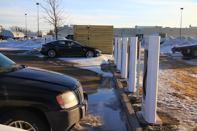
So, to circle around to the Supercharger stations again, I have to say that I'm almost wholly unimpressed with the places where these stations have been going in. While Superchargers offer the ability to recharge a Tesla vehicle very quickly (adding 200 miles of range to an empty battery in under 40 minutes), they're usually located in suburban-style strips or the fringes of shopping mall parking lots.

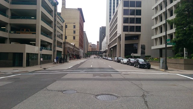
Here's the one in Albert Lea, four stalls in the parking lot of an AmericInn hotel just off I-90 (the first exit west of I-35). If you're going to be waiting for your car to charge for 20 to 40 minutes, it would seem ideal to use that time to shop or grab a bite to eat. But the nearest food here is at Burger King, and it's not a very walkable environment (no sidewalks):

img_7909


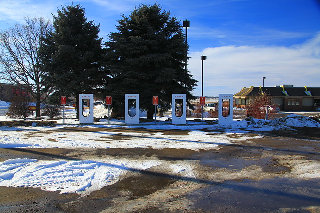
Here's the one in Worthington, six stalls in the parking lot of a Ground Round restaurant. There was one couple there sitting in their car waiting for it to charge, also in a sidewalkless suburban-style sprawl zone:

img_7914

Of course, the Supercharger stations are located close to the highway, much like many regular filling stations. Sometimes they're in the parking lots of restaurants, sometimes hotels. But in most cases, the stations are located only a couple of minutes away from nice, walkable central business districts.

One of the thing that frustrates me most about driving by car these days is the sameness that's found wherever you stop. Mostly the same fast-food joints, with only faint whiffs of what makes a place unique.

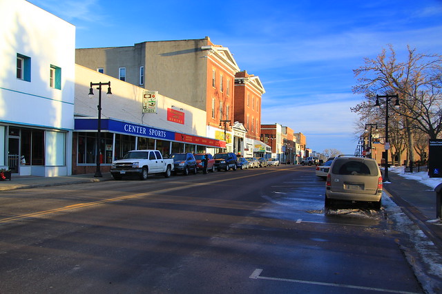
On my January trek out to visit the stations, I decided to stop in downtown Worthington (I skipped central Albert Lea, though there is a streets.mn writeup on that Main Street already).

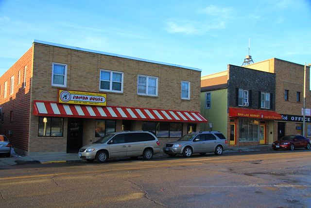
Worthington has a decent central business district, a variety of 1- to 3-story buildings:

img_7920

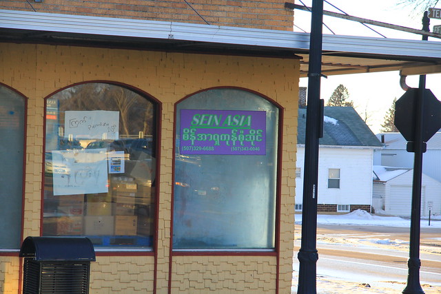
There were a number of Mexican and Asian restaurants and shops. I never would have guessed. I couldn't quite figure out the language of this sign:

img_7922

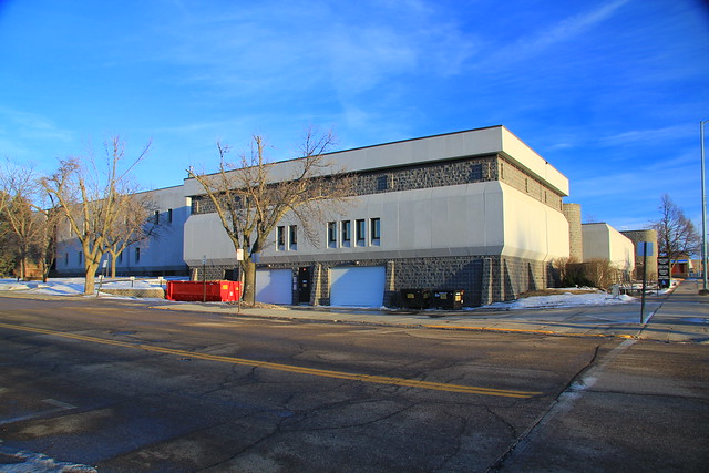
It isn't all traditional buildings. As in countless other cities, it was clear that a portion of the town center had been torn down, in this case to make way for a fortresslike government center:

img_7924

Some of the restaurants:

img_7925

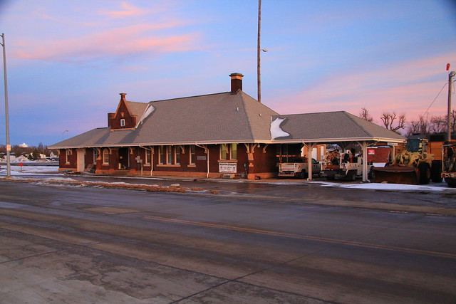
And, for good measure, the former train station, still used as offices by Union Pacific. Perhaps someday in my lifetime, they'll use it again for passenger trains.

img_7927

So if you were setting up stopping points for a cross-country adventure, which would you pick? I'm a fan of the walkable downtown—even in this small community, there was plenty to see in a short distance of the free downtown parking lot. Placing chargers in town centers would help reinforce those communities by bringing travelers to see something they wouldn't quite expect otherwise, alleviating the blandness of the highway.

While I'm not a fan of their charger locations, it won't impact me for a while. If and until I need to get a new car, and I turn out to be able to afford one of their next-generation vehicles, charging locations remain a question for Tesla and their existing customer base. Do their customers want to be stuck in their cars in unwalkable suburban landscapes while they wait to charge up, or will they demand something better?

Perhaps non-Tesla charging stations will take a hint and be placed in better locations, though that almost becomes a requirement for other vehicles. Most electric cars on the road in the U.S. today only take current from slower Level 1 or Level 2 chargers (basically 120- or 240-volt power), and take several hours to fully charge. Topping off doesn't take as long, but still, if you're going to be stuck in one place for a while, public chargers pretty much need to be in walkable locations.

I'm not sure if I'll ever get a pure electric car. I'm an apartment dweller, which will make charging at home difficult for the foreseeable future. I'll need some sort of fast public charging infrastructure, unless my building management decides to take the initiative and set something up themselves. Most existing electrics also only offer driving range of roughly 80-100 miles (sometimes only half that). I have a recurring need to drive 80-100 miles on relatively short notice, so I'll either need something with a bigger battery or a growth in the availability of fast-charging infrastructure.

Tesla's Supercharger network isn't quite going to work either, at least for now—they're currently Tesla-specific proprietary technology, not offered on any other vehicles. But even if another manufacturer licensed the necessary pieces, batteries would need to grow as well. Those chargers in Worthington and Albert Lea are 114 miles apart, farther than virtually any non-Tesla electric vehicle can go today. There is an emerging nationwide standard for fast-charging which should help cars with smaller batteries, but the chargers aren't yet widely deployed, and very few cars have been built with the appropriate on-board connector.

It's both amazing and disheartening to see how far electric vehicles have come in the last decade. Huge leaps forward have been made, but with many more still left to go.

Friday, January 17, 2014

Metro transit opportunities in plain sight

Minneapolis-Saint Paul rail map, May 2013 (MnDOT)

I verge on being a train nut, and if I'm honest, I wish passenger service could be reactivated on most of the remaining rail lines in the U.S.  The rail network faces extreme competition from a dense mesh of seemingly free roads, so it's always easy to bash the expense of trains, but there are many cases where it provides a good alternative to highway expansion, and can provide city-to-city and town-to-town transportation better than buses on freeways. Freeways are designed for non-stop travel—the antithesis of most forms of transit—and often represent the second or third bypass of a community, often unwalkable distances from historic town centers. On the other hand, rails were often built very early and usually still reach core areas.

In Minnesota, most towns and cities that existed before World War II grew up on rail lines.  About half of the state and country's rail network has now been ripped up—in many cases, that was probably the right outcome, but the national rail network had been dragged down by decades of over-regulation. The federal government began relaxing rules in the second half of the 20th century, and the abandonment of lines accelerated around the time of the 1980 Staggers Rail Act, which reformed 90-year-old legislation designed for a time when the railroads really did need to be reined in. After more than three decades of retrenchment and consolidation, the nation's rail system is actually carrying record levels of traffic, but rail companies still lean toward abandonment of little-used lines rather than rehabilitation or expansion.

So while we're probably near the bottoming out of total rail miles, it's important to look at what remains and ensure that we don't lose additional pieces. It's worrying to hear talk of buying out the Twin Cities and Western in order to make way for Southwest LRT.  Despite being classified as a "short line" railroad, The Twin Cities and Western system has about 250 miles of track, including about 95 miles owned by the Minnesota Valley Railroad Authority (who subsidize operations to provide cheaper transportation for farmers and businesses along th eline), but it only interconnects with other railroads in Minneapolis, St. Louis Park (at a very constrained junction), and far to the west in Appleton. Chopping off the line would be a bad decision, and some reroutes could do more harm than good, especially since the line leads directly to the Northstar station at Target Field as things stand today (at least one reroute option would send trains south of the Minnesota and Mississippi rivers).

Keeping Minnesotans mobile in the 21st century is a big challenge as the population ages, we deal with climate change, and we try to minimize the death tolls on our roadways while also transitioning to an always-on society with pervasive electronic communication. It's important to take a broad look to try and find ways to provide quality transportation that connects people and places in ways that reinforces walkable, bikeable, and transitable infrastructure.

Most of Minnesota's population is in the Twin Cities region, about 3.4 million people out of the state's total 5.4 million (the U.S. Census Bureau includes some Wisconsin counties for the metro population, though including the St. Cloud area more than balances out that loss). With that balance, it's vitally important to improve transit service within the Twin Cities, even though it's a target of lazy criticism by outstate representatives.  If we were to set a goal of setting up transportation service to reach 80 or 90 percent of the state's population, the Twin Cities can't be ignored (most towns and cities of significant size are also clustered in the metro). But by the same token, focusing exclusively on the Twin Cities would only reach a maximum of 63% of the state's population.

Getting back to the rail network, it's worth pointing out that much of the state's system only has a limited amount of traffic as things stand today. Amtrak and Northstar run on some of the busiest routes, making access charges very expensive. Some of the segment used by Northstar sees about 63 trains per day, but the Twin Cities and Western line that's causing headaches for Southwest LRT planners only has three.

While I'm not in favor of buying out the TC&W in order to shut it down, I do think there would be value buying up a segment of it in order to making it a passenger-primary corridor, while maintaining freight access.  It could be upgraded to allow many commuter trains per day without adversely affecting freight operations. A possible outcome might be to initially build Southwest LRT through Uptown to Hopkins, which would likely have decent all-day ridership, and use the TC&W tracks to reach more commuter-oriented Eden Prairie and Shakopee.

But given the late stage of Southwest LRT planning, I'll focus my attention farther north, in the Bottineau corridor. Like Southwest, it has appealed to area planners since it's a historic rail corridor, currently known as the Monticello Subdivision. BNSF Railway currently operates just two trains per day on the line, which immediately parallels Interstate 94 and Hennepin County Road 81.  At the northern extreme by the Monticello Nuclear Power Plant, only a few trains per year use the track, putting that portion at risk of abandonment.


View BNSF Monticello Subdivision in a larger map

Interstate 94 is very busy on that stretch, and a widening project was recently pushed through for a three-mile stretch between Rogers and Saint Michael, and there will likely be continuing political pressure to keep widening the Interstate farther northwest. "Nobody will deny that Interstate 94 will eventually be three lanes in each direction all the way from the Twin Cities to Saint Cloud," began a report from KARE 11 this past summer, which cited the support of Michele Bachmann and other politicians. Is that common wisdom really appropriate, when a potential relief valve sits a less than a quarter-mile away from the highway? It's frustrating that train service had not been brought up as an alternative, at least at any time within the last decade.

Yes, it would overlap with Bottineau, and it's only three to six miles from Northstar, though questions like that rarely arise when discussing highways (I-94, I-694, I-494, US-10, US-169, MN-100, MN-101, and MN-610 are in the corridor).  The line formerly went to St. Cloud and beyond, but had been truncated, probably due to competition from I-94 which it parallels so closely.  There would be potential to rebuild portions of that line, or to connect across the river to the Northstar corridor to keep operations relatively consolidated.

I'm sure there would be significant costs for rehabilitating tracks, as much of the line is only rated for 10 to 25 mph as things stand today.  The Northstar service was mostly built on tracks that already carried Amtrak's Empire Builder, so in theory the costs to upgrade track would have been negligible, but it turned out that much of the route still saw significant rehabilitation anyway (only a short distance of new track was built for Northstar, primarily at the Big Lake maintenance facility, and for the spur that leads to the Target Field station in Minneapolis).

A grade separation project in Crystal where the line crosses the Canadian Pacific railway's 20-train-per-day main line would also be needed if service frequency was ramped up to the maximum, but probably wouldn't be necessary to begin operations. But an improvement project there could also lead to a proper junction at that spot, potentially allowing commuter service along the CP line, which parallels Minnesota State Highay 55.  Rockford or Buffalo could be good endpoints for commuter service, and intercity rail could continue as far as Winnipeg, opening up a mid-continent connection between the Amtrak and the Canadian VIA Rail network (today the gap is more than 2,000 miles, between the Toronto area in the east and Vancouver in the west).

Ideally, future rail services will be implemented with smaller, more nimble train vehicles than the bulky equipment we see on Northstar. The Federal Railroad Administration appears to be moving toward allowing lightweight diesel multiple unit (DMU) vehicles on legacy freight lines, which bear much closer resemblance to our Blue and Green Line light-rail cars. The combination of lighter/cheaper vehicles, better stop spacing, more frequent service, and opportunity for new branches makes the Monticello line a winner in my book. The idea had probably been examined and tossed aside in some long-forgotten Alternatives Analysis, but it really shouldn't be ignored, and the whole Twin Cities system should get more attention.

Statewide, there was some attention paid to restoring intercity rail service in the 2010 State Rail Plan, though it was a wholly Twin Cities-centric network, possibly ignoring some good opportunities for outstate connectivity, such as along the Dakota, Minnesota and Eastern line which stretches across the state's southern tier.  Aside from (perhaps) corridors to Rochester, St. Cloud, and Duluth, it's unlikely that these routes can operate at a profit, but their value should be measured in other ways.

Having grown up in a small town, I see a great benefit from building up and reinforce a good rail (and bus) network to in order to provide greater flexibility for growing families. Children and parents are both constrained when one has to take on the duty of chauffeuring others to remote commercial airports or other destinations because of insufficient existing services. Proper stations for rail or bus service also provide focal points which can reinforce traditional town centers, ideally counteracting today's trend of building up along highways, and frontage roads.  They won't work miracles, but are important tools for reinforcing good urbanism.

Tuesday, January 14, 2014

Improper signal maintenance actions led to October 2012 Amtrak derailment


In October/November, the National Transportation Safety Board finalized and released their report on the derailment of an Amtrak ''Wolverine'' train in Niles, Michigan back in October 2012. I felt that this was an extremely important investigation because the incident occurred on a segment of Amtrak-owned "high-speed" track, the first segment of modern 110-mph running in the United States outside of the Northeast. I've covered the event previously (here and here). My initial article was a bit too speculative about what happened—it quickly became clear that the train engineer responded appropriately to the signal indications, and that the positive train control (PTC) overlay (specifically Incremental Train Control System, or ITCS, in this case) behaved as designed.


As seen in the left-hand photo above, the train engineer had a "clear" signal (green over red), permitting the train to operate at the line's maximum speed of 110 mph. However, the switch was "reversed", aligned to take the train into a yard where speed is limited to just 15 mph (right). The in-cab signals had also presented a "clear" indication to the locomotive engineer, but he waited until the physical signals were visible before beginning to accelerate. The train hit the misaligned switch at 61 miles per hour. Fortunately there weren't any fatalities in the incident, though 13 people were injured (8 were taken to the hospital, but none of the injuries were life-threatening).

There had been maintenance work on the track shortly before the Amtrak train went through. A maintenance-of-way crew had been using a tamping machine, which uses vibrating paddles to pack ballast rocks around the rail ties/sleepers. Somehow this action had made it so the switch to the Niles yard could not move between positions properly. At the request of the maintenance crew (who were finishing up their work), the remote train director (dispatcher) tried aligning the switch to allow them to move equipment into the yard, but at 9:17 AM, the switch reported that it could not properly detect the position of the switch points.

The dispatcher called an Amtrak signal supervisor at 9:18, who attempted to forward the request to one of the regular maintainers. After being unable to get a response, he headed out to the site himself and arrived at 9:55 AM. The Wolverine was due to stop at the station in Niles at 10:07 and then go through the switch a few moments later, so the supervisor had less than fifteen minutes to find and fix the problem for the train to continue on time.

From the NTSB report:
He said that he first attempted to correct the problem at the power-operated switch machine but was unsuccessful. He said that he entered the signal bungalow and removed two cartridge fuses, opened two terminal nuts on the terminal board, and applied local battery power using two jumper wires. The signal supervisor stated that when the battery power was applied, the local control panel indication lights showed that the #2 switch was aligned and locked normal. The signal supervisor stated that he did not verify the physical position of the #2 switch before applying the jumper wire.

The train director contacted the signal supervisor on the radio and informed him that the #2 switch was now indicating normal on the display and asked if everything was safe for train 350 to proceed eastward. The signal supervisor told the train director that the switch was good for the normal movement. The conversation concluded at 10:10 a.m. as Amtrak train 350 approached CP 190. The signal supervisor said that he observed train 350 approaching CP 190. He said that as the train entered the yard tracks, he realized what had occurred, and he then removed the jumper wires and reinstalled the cartridge fuses. The signal supervisor did not notify anyone at this time that he had used jumper wires just before the derailment, and he did not leave the signal bungalow to aid the passengers and crew on the derailed train.

This wasn't the correct way to do maintenance on the signals. According to the rest of the report, jumper wires are known to cause false indications, and should only be used after other methods of diagnosing the problem have been exhausted. In addition, jumpers are only to be used after getting appropriate approval in the management chain, notifying the dispatcher, and "implement alternative means of protection".  Presumably some flags or signs placed along the right-of-way near the signals to indicate they're undergoing maintenance.  The PTC system along the tracks should also have a method for transmitting information about work zones to locomotive engineers.

However, because those precautions weren't taken, the PTC system relayed what it was told by the legacy signal equipment. The crash likely would have been worse if not for the train engineer's distrust of the in-cab signals, as the train would have accelerated sooner and hit the switch at a higher speed.  Needless to say, I'm really curious how best-of-breed fully-integrated high-speed signaling handles this type of situation, as opposed to the overlay systems we're expecting to see deployed across the country as PTC is implemented.