Monday, September 21, 2015

Getting rolling on rail to Eau Claire

This week, a citizen group is holding a couple of public meetings to advocate for a passenger rail link between the Twin Cities and Eau Claire, Wisconsin, a corridor that MnDOT suggested in its 2010 State Rail Plan should be built before the year 2030.
The meeting announcement has led me to dig into the route and do some analysis of my own, though this doesn't necessarily reflect what will be presented by the St. Croix Valley Rail Group on Wednesday.


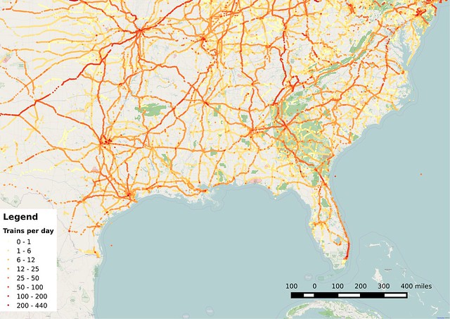
MnDOT's plan suggested a regional rail service operating approximately four round-trips through the day, though presumably they would be spread out, making it unlike peak-only commuter rail service. (Commuter rail had been studied and discarded on this route as part of the Gateway Corridor study, which is instead looking at bus rapid transit for the much shorter Gold Line route).


Wisconsin's Department of Transportation had also been working on a 20-year rail plan around the same time as Minnesota, though it was put on pause following the Tea Party-infused political surge later that year which put Governor Scott Walker in office alongside a much more conservative legislature in the winter of 2010–2011.

Wisconsin then ended up with a near-total abandonment of passenger rail planning. The official state rail plan document was finally approved last year, and includes possible links to Eau Claire, Madison (where federal funding was famously turned down by the state), and Green Bay.

That's good, but a bit underwhelming, considering how Wisconsin's population is less heavily concentrated than Minnesota's (see this map of cities with populations greater than 5,000 and contrast it to the one for Minnesota), so I expected a couple of other interesting links. These seem to be cribbed from older Midwest Regional Rail Initiative plans, a multi-state effort for high(er)-speed rail that was once led by Wisconsin.

Wisconsin's rail plan for the year 2030 includes possible connections to Eau Claire, Madison, and Green Bay.
One significant link that seems like it's missing is some sort of connection from Eau Claire to Green Bay. Frustratingly, the most direct link via Wausau has been mostly abandoned at this point, though it would still be possible to have a fairly good path through Stevens Point and Appleton (which might make it a better idea anyway).

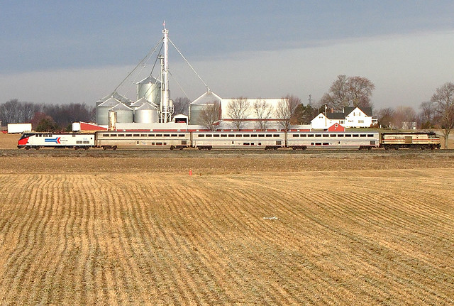
But for this post, I want to focus on Eau Claire, which lies about 100 miles east of Minneapolis. The city itself only has a population of about 65,000, though there are a number of nearby towns including Chippewa Falls which creates a small metro area of about 165,000 people. Menomonie is also close by, and the Eau Claire-Chippewa Falls-Menomonie Combined Metropolitan Statistical Area now reaches a population of almost 210,000.

Eau Claire and Menomonie (at nearby Menomonie Junction) had rail service on the Chicago & North Western Railway's Twin Cities "400" until July 23, 1963, about 8 years before the introduction of Amtrak. A timetable from 1962 listed travel time at 114 to 120 minutes from Minneapolis to Eau Claire and 85 to 90 minutes from St. Paul to Eau Claire (the eastbound train was slightly faster, at least on paper).

This was one of the three fastest trains to run between the Twin Cities and Chicago, although it had the major flaw that it only ran once per day per direction. That made it very hard to compete with automobile and air travel. Even today, Eau Claire has two daily round-trip flights to Chicago, subsidized through the Essential Air Service program (though they will still cost you more than $350 round-trip).

Restoring passenger rail service on the corridor has the potential to provide a more frequent transportation option for the area's population while also reducing costs, especially compared to flying: The existing Eau Claire air service costs close to 70 cents per mile when EAS funding is included, while the average cost for Amtrak to carry a passenger one mile is about 40 cents (also including their subsidy).

It's certainly a bit tough to imagine reestablishing service that was abandoned by the railroads more than 50 years ago now, though it's important to note that Wisconsin's population has grown by 40% since 1963, and Minnesota's has grown by 55%. Even if the potential market for rail service remains relatively small, it continues to grow year over year.

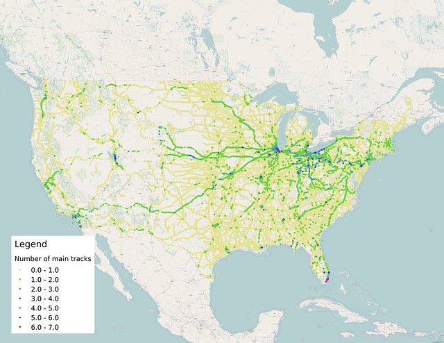
So, what are the challenges facing restoration of service on this line? Here's a map I put together of single-tracking and sidings along the corridor, to give an idea of the route's capacity:


Between Saint Paul and Eau Claire, there are only four places with long sidings or segments of double-tracking, plus another short siding at Menomonie Junction, which limits how often trains can pass each other. It's 38 miles between the double-tracked segment in Hudson eastward to Menomonie, according to Google Maps' "Satellite" view, and about 46 miles from Hudson to the longer siding near Elk Mound. [Update: It turns out that I missed a siding between Woodville and Hersey, which reduces the longest stretch of single-tracking to 21 miles.]

MnDOT's rail plan only suggested running four round-trips per day (eight total trains), and the Federal Railroad Administration's Highway-Rail Crossing Inventory suggests that there are only about four freight trains per day, so with appropriate scheduling, it's conceivable that 12 daily trains (less than one per hour) could operate over that gap without needing any new infrastructure. Still, it would be better to add a few new sidings to shorten the gap. Even with upgraded track speeds, passenger trains could take half an hour to 45 minutes to cover the gap, and freights could take more than an hour, potentially leading to serious delays on trips that should only take two hours end-to-end.

A few additional sidings would be a good idea, likely including one near Baldwin to be about halfway along the line. There are also clusters of freight customers near Menomonie and Truax which should have their spurs connected to shared sidings. That would allow the main track to be kept clear for through traffic while freight crews deal with the relatively slow process of attaching and detaching rail cars at the customer sites.

Much more of the line used to have double-track and sidings, but it was pulled out over the decades as freight traffic consolidated onto fewer routes and the need to keep extra track for passenger service disappeared. This means that there are few physical obstacles to restoring it, but it will cost a considerable amount of money. Each siding would likely cost several million dollars.

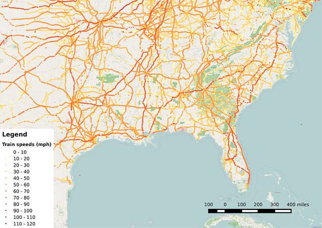
The tracks have also been allowed to degrade over the years, so the allowed train speeds are not as high as they once were. Freight trains can reach a maximum of 50 mph on the route, but only for a few short segments, according to a 2007 Union Pacific timetable I scraped off the Internet a few years ago. 85% of the route was limited to 30 mph or less at that time, though things may have changed since then.

The timetable notes that passenger trains are allowed to go 10 mph faster than freights on the line, but that doesn't help much when comparing it to the nearby Interstate 94 which has recently been updated with 70 mph speed limits (increasing from a rural freeway limit of 65 mph that Wisconsin had for many years).

Restoring tracks to 79 mph service, the typical standard for passenger service in the U.S., or beyond into "high-speed" territory will require an investment of a few hundred thousand dollars per mile. This type of work involves removing worn-out ties/sleepers, refreshing track ballast, and smoothing and straightening the rails themselves. Depending on the age and quality of the rails, they may only need to be run through a grinding machine to restore a good running surface, but bad segments would obviously need to be replaced.

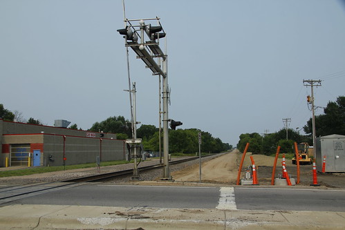
The line is in relatively good shape as far as signaling goes, but would still need to be significantly improved for passenger trains to run on the route. The line has automatic block signaling (ABS) in place for all but about six miles of track, but future passenger lines are required to have positive train control (PTC). It's unclear how much that would need to cost, since it is still a new technology and price estimates have fluctuated wildly over the past few years.

That's a major hurdle, though the freight company may be required to implement it anyway if it carries hazardous materials on the route. If that's the case, then adding passenger service back on the route would be beneficial to the railroad, since the costs could be shared between the freight and passenger operations (with passenger trains most likely being funded by state and local governments, though the possibility of a privately-funded operation probably shouldn't be discarded entirely).

If the line is extended beyond Eau Claire as shown in the Wisconsin Rail Plan map above, the challenges would be similar for the next 120 miles of track. However, the last nine miles between Wyeville and Camp Douglas (where the line could merge with today's route of the Empire Builder) deserves special note: That section of track appears to be disused and in danger of abandonment. Google's aerial images show the right-of-way in a condition of poor repair, and miles of underused rail cars were parked there for long-term storage when pictures were taken.

That's yet another reason why planning of passenger service to or through Eau Claire needs to get going right away, before those tracks disappear.

The St. Croix Valley Rail Group is planning two presentations for Wednesday, September 23rd. I haven't had any direct contact with the group, but thought the timing presented a good opportunity to do some of my own digging. The meetings are scheduled at 5:30 and 7:00 pm, respectively:
River Falls Public Library
140 Union St
River Falls, WI
5:30 pm

Hudson House Grand Hotel
1616 Crest View Drive
Hudson, WI
7:00 pm

Wednesday, September 9, 2015

Sunset Unlimited: Restoring passenger rail on the Gulf Coast

Up here in Saint Paul, the Mississippi River passes within blocks of where I live and work. As the tenth anniversary of Hurricane Katrina approached, I started looking toward the other end of this waterway that links the Midwest to the South because I wanted to better understand the lasting impact of the storm on one of my interests, the nation's passenger rail system. Ever since the hurricane happened, service on Amtrak's Sunset Limited route has been suspended east of New Orleans, and the reasons why haven't been well-defined.

What could have damaged tracks so badly that it would still be out of service ten years later? Even though Katrina was the deadliest storm to hit the U.S. since 1928, was its impact so great that we couldn't restore the modest service that was running before the storm? In reality, the hurricane is probably just a convenient excuse for the halt of passenger operations and not an outcome that should be tolerated.

Surprisingly, when Amtrak formed in 1971, the system didn't include any service between New Orleans and northern Florida. It took over two decades of campaigning by the region before a direct link was reestablished in 1993. Even when the train did run on the line, it was only three times a week each direction—the same frequency that it's always had on the route's western section from Los Angeles to New Orleans.

I decided to take a look at the layout of tracks along the route to try and understand why it has continued to take so long, using a map format like what I used on the Empire Builder route several months ago. I focused on the 770-mile stretch that is still suspended between New Orleans and Orlando.


When I started, I expected to find something obviously out of place along the route, but as I traced the line through Louisiana, Mississippi, Alabama, and Florida, everything seemed to be in good order.

However, it was obvious from the aerial imagery that there were a few different sections to the corridor which carry different amounts of traffic and are maintained to different standards. I compared my map to railroad crossing data from the Federal Railroad Administration (which I used to make the map in my previous post) and made note of these five main segments:
  • Starting from the west, the Sunset Limited used mainline tracks that run from New Orleans to Mobile, Alabama, and then toward Montgomery, though the train turns off the mainline in the small town of Flomaton, Alabama, right next to the border with Florida. For this distance of about 210 miles, the track see about 15 to 18 freight trains per day. The FRA railroad crossing database still lists top speeds up to 79 mph, which is the maximum for most passenger rail lines across the U.S. The longest distance I found between sidings was 13.8 miles.
  • From Flomaton, the line heads south to Pensacola, Florida and then east to Tallahassee, covering a distance of about 240 miles. This section of the line is much quieter, only seeing two or three trains per day. Speeds appear to range from 30 mph up to 59 mph, a number that signifies that the line lacks any illuminated signals to help control train movements. The longest distance between sidings here is 31.1 miles
  • For the next 105 miles from Tallahassee to Lake City, there are about 7 trains per day, and top speeds now appear to be about 40 mph in most places (which appears to be a reduction in speed from before the storm in 2005). The longest stretch between sidings is 18.4 miles.
  • The 62 miles from Lake City to Jacksonville host 8 to 12 trains per day and have speeds up to 79 mph, with the longest single-track segment being 12.5 miles.
  • The 151 miles from Jacksonville to Orlando still has three Amtrak passenger trains in operation, the Silver Meteor, Silver Star, and the Auto Train (an oddball route that only stops in the Orlando suburb of Sanford). The FRA data indicates there are 8-14 trains per day in total, though it doesn't seem to include traffic from the new SunRail commuter service near Orlando. the spacing between sidings is fairly short, only reaching up to 11 miles apart. Most of the commuter rail section near Orlando is double-tracked.
CSX Transportation is the railroad that owns the tracks all the way from New Orleans to Orlando (the western segment of the train that is still in operation is run on Union Pacific tracks from Los Angeles to Lake Charles, Louisiana, where it switches to BNSF tracks for the rest of the route to N.O.). Their heaviest damage in the storm was between New Orleans and Mobile.

Just east of New Orleans, the tracks cross the Intracoastal Waterway, which connects Lake Pontchartrain to the Gulf of Mexico. The line then passes into Mississippi and through communities such as Bay St. Louis, Pass Christian, and Biloxi, which were among the places hit hardest by the wind and storm surge during the hurricane. In Pass Christian, the surge measured 27.8 feet and was combined with a relatively high tide.

That level of surge is enough to completely obliterate homes and other modest-sized buildings. The rail line suffered too as tracks were washed out and bridges destroyed and electrical signaling huts that were flooded with saltwater as the water crashed ashore. In some places, ships and barges floated up onto the ground and eventually settled onto tracks as the waters receded.

Map of train traffic volumes at grade crossings in the southeastern U.S.

About 100 miles of track was severely damaged or destroyed, but with 15 to 18 trains per day, it was important for the railroad to be repaired and brought back into service. The railroad and several contracting companies worked for four months to restore service between New Orleans and Mobile.

It's less clear how bad the situation was in Florida, along the second notable section of track in my list. Pensacola did experience a modest storm surge of about five feet, but that didn't cause as much damage, so the line was back in operation pretty quickly. Only the track nearest Pensacola would have been affected by storm surge—most of the distance from Flomaton to Tallahassee is inland and would have only been damaged by wind and creeks and rivers swollen by rain.

And yet, this relatively protected stretch of track is probably the real culprit preventing the resumption of service. With only two or three trains per day, there isn't enough revenue from freight traffic to warrant maintaining tracks at the level that passenger trains really need.

I was surprised to see that train frequencies were so low along that stretch of track, since the Gulf Coast seems like an important economic region to me. But rail freight tends to move in a more hub-and-spoke pattern like airlines rather than a point-to-point service like highway vehicles do.

Map of train speeds at grade crossings in the southeastern U.S.

A line with just two or three freights per day often only justifies enough maintenance to operate at speeds of 10 to 30 miles per hour, which is far too low for passenger services. Extra outside funding is often needed to cover the cost gap when passenger operations exist on otherwise quiet lines. That's likely one of the reasons why Sunset Limited service hasn't resumed: Either previous funding sources dried up, or the railroad increased the amount of money they were asking for after the hurricane and subsequent repair work.

Running more trains, whether freight or passenger, would allow the cost to be spread more widely, but that idea hasn't gotten much traction so far. Amtrak studied the route back in 2009, but only looked at either restoring the previous tri-weekly train or two options for running a daily service (one was an extension of the City of New Orleans from Chicago, while the other was a standalone New Orleans to Orlando train).

Amtrak's underwhelming conclusion? Restore the train as it had been before, despite it's infrequent service and all the delays and complication involved in running a train all the way from coast to coast.

Studies like that are asking the wrong question and getting the wrong answer. What the country really needs is for Amtrak to add frequent, speedy service so that their trains can be used as day-to-day transportation for many more people. That would broaden the benefits that the company provides, and hopefully reduce their operating losses as well.

Here are populations for some of the metropolitan areas from New Orleans on east to Orlando:
  • New Orleans region - 1.2 million
  • Gulfport region - 383,000 
  • Mobile region - 414,000
  • Pensacola region - 461,000
  • Tallahassee region - 376,000
  • Jacksonville region - 1.4-1.5 million
  • Orlando region - 2.3-3.0 million
It's about 620 miles from New Orleans to Jacksonville, the longest gap between 1-million-plus metros on the corridor. That's considerably longer than the 400-mile rule of thumb used in rail planning, though there are a lot of people questioning whether that's a valid rule.

Still, there are a few shorter segments that look good on paper. Here in Minnesota, we've been looking at adding eight daily round-trips on the 150-mile Northern Lights Express corridor from Minneapolis to Duluth. The Twin Cities has a population up to 3.5 or 3.8 million, and the Duluth area has a population around 280,000.

Orlando and Jacksonville two 1-million-plus metros about 150 miles apart, which makes that corridor an ideal candidate for increased rail service. New Orleans-Gulfport-Mobile and Jacksonville-Tallahassee are also pretty similar distances (144 and 167 miles, respectively).

Having multiple daily trips on the eastern and western segments would probably improve the viability of the middle section of the line, the most likely source of trouble today. The service improvements might even justify a new, more direct rail alignment between Mobile and Pensacola.

Similarly, if we look to cities west of New Orleans, there are some interesting combinations possible if the line started in Texas:
  • Baton Rouge region - 820,000
  • Lafayette region - 479,000 to 616,000
  • Houston region - 6.3 million
  • San Antonio region - 2.3 million
Houston to New Orleans is about 363 miles, which makes puts it in that ideal distance zone for frequent, high-speed service. Houston is also a notable destination because the Texas Central high-speed rail service is being planned to connect that city to the Dallas-Fort Worth metroplex. Frustratingly, a segment of track between Lafayette and Baton Rouge has been abandoned, so it would take some significant investment to link that city, but it would be worthwhile in the long run.

Amtrak's trouble with restoring the Sunset Limited or pursuing even better options shares the same symptoms that the company has all across the country. They've lacked the funding and motivation to pursue service improvements in areas that would bring the biggest bang for the buck while also adding to the system's overall connectivity. Amtrak needs better funding to pursue these opportunities, otherwise we'll look back in a couple decades and still find a skeletal national network that hardly looks different than what we have today.

Tuesday, July 28, 2015

The single-tracked world of American railroading


Here's a map I put together using the Federal Railroad Administration's Highway-Rail Crossing Inventory database, focusing on the number of main tracks at public grade crossings across the country. The main thing to see is that the vast majority of our rail infrastructure is single-tracked, only allowing trains to travel in one direction at a time on segments of track that don't have passing sidings. (For this version of the map, I didn't attempt to show sidings.)

There are only a dozen or so major double-tracked corridors that show up on this map. Some routes, like the double/quadruple-tracked Northeast Corridor between Washington, D.C. and Boston, Massachusetts, are mostly or wholly invisible, since they are grade-separated and don't have any level crossings. Many metropolitan areas and rail hubs have splotches where there are three or more tracks, but they're usually for very limited distances.

Some rail routes are double-tracked due to running heavy, slow trains. This includes routes in northern Minnesota that were built to haul iron ore/taconite to seaports on Lake Superior. In Wyoming's Powder River Basin, the triple-tracked Joint Line shows just a few public crossings. It's used to haul coal out from the region's mines to connecting routes, some of which are themselves double-tracked.

BNSF's Southern Transcon connecting Southern California to Chicago shows up particularly well—it's a route that carries a lot of intermodal traffic from West Coast ports. Union Pacific's corridor between Northern California and Chicago doesn't show up quite as much—for some reason, there aren't many crossings shown out west, though it also has more single-tracking.

Routes that have a significant amount of double-tracking correspond pretty well with maps of Amtrak service. Out west, the Amtrak Cascades corridor is easily visible between Oregon and Washington, and the Capitol Corridor stands out in California. Other long-distance routes in the Eastern U.S. and Midwest also show up pretty well: The route of the City of New Orleans, the Crescent, and the Silver Star (which shares parts of its route with a couple other long-distance Amtrak services).

Double-tracking isn't a requirement for passenger routes, but double-tracked lines make scheduling much more flexible and can dramatically increase capacity over lines that only have a single main track. Single-tracked lines are constrained in the number of trains they can carry by the number of sidings, spacing between them, and siding length, not to mention the general condition of the line and other design features that limit train speeds.

Most rail maps of the United States don't differentiate between busy and lightly-used rail lines, in contrast to maps of the highway system which are able to classify roads based on design. Each can be misleading, though—just as a busy rail line doesn't look much different than a quiet one, it also isn't obvious from the design that that Interstate 94 is far busier in Wisconsin than it is in North Dakota or Montana.

Monday, July 6, 2015

Second train to Chicago: Still running late

Last Thursday, after a delay of almost 2½ years, the Amtrak study for adding a second daily train between the Chicago and the Twin Cities was finally released. The agreement to begin the supposed nine-month study was signed back on May 3, 2012, and it finally arrived on July 2, 2015, thirty-eight months later. Cue your Amtrak jokes now.

The delay is bad. Even worse is the fact that this is just a feasibility study without any actionable output—just more data to put into another phase of study later on. The level of detail is pretty bare-bones, and fails to put this improvement in the context of any other projects in Minnesota's state rail plan (Wisconsin doesn't even have a rail plan, because Scott Walker). And of course, there's no funding in place to do anything more at this point, so we'll continue along the course of twiddling thumbs and wasting time.

I grew even more confused on Thursday and Friday as I saw news reports pop up that were literally pulling a little data from column "A", a little from column "B", and yet more from column "C". The reports were based on the press release, which was based on the executive summary, which was based on the study itself, but apparently only a version that had been tossed in a blender first.

None of these documents alone are enough to understand what's going on. The press release got Bob Collins confused. The study itself got me confused. You probably need to look at all three, and this is for a study that is relatively basic—something that should be routine and unremarkable.

The study conclusions—or rather, the conclusions put into the executive summary because the study itself drew no real conclusions—are themselves unremarkable and obvious, perhaps looking a bit preordained: Yes, adding a second train is a good idea. Yes, it would increase ridership along the corridor—more than double it, actually. Yes, ending it in St. Paul is the cheapest, simplest option.

Is that the best option? Yes. Well, maybe. Um, er—just wait for the next phase of study when we actually bother to do benefit-cost analysis.

Kitty faceplant
Current mood: Faceplant

There is some helpful information coming out of the study from computer modeling of train ridership, operating costs, and getting an idea of the upgrades needed along the route to support the extra. It's embarrassing that it took so long for the information to be generated, though.

The study looks at four main scenarios, all based on the Empire Builder's current travel corridor, but with the western endpoint somewhere in the Twin Cities or St. Cloud area rather than all the way out in Seattle and Portland. The options are:
  • Scenario 1: Run from Chicago to St. Cloud, with stops at St. Paul Union Depot and Target Field station in Minneapolis.
  • Scenario 2: Run from Chicago to St. Cloud, with stops at St. Paul Union Depot and Fridley's Northstar station (bypassing Minneapolis).
  • Scenario 3: Run from Chicago to Minneapolis, still including a stop at St. Paul Union Depot.
  • Scenario 4: Run from Chicago and terminate at St. Paul Union Depot.
Pay no attention to the orange line. Or the black line. Or Sturtevant.
Obviously, "Scenario 4" is the cheapest to implement, since it's the shortest route. It's the one recommended in the executive summary, although that's a short-sighted conclusion, if you ask me.

Each scenario was evaluated with three different alternatives based on different departure times from St. Paul, given the letters A, B, and C. These have a decreasing order of implementation cost—schedule "A" encounters the most rail traffic congestion and needs the largest number of improvements, while schedule "C" is least congested and therefore the cheapest.

Ridership is apparently the reverse, although only schedules "A" and "B" were evaluated in detail. Schedule "C" is assumed to have the same ridership and operating costs as "B", which may or may not be a valid idea. You'll only find schedules "A" and "B" in the study report itself. "C" is mentioned in passing, but you need to look at the executive summary to see it listed.

The executive summary (and the press release that was derived from it) quoted the capital cost ($95 million) from Scenario 4C, annual ridership (155,000) from Scenario 4B, and an annual operating subsidy ($6.6 million) that matches Scenario 4A.

Okay, I kind of get the first two, but what's the deal with that subsidy number? For an era where we are obsessed with cost subsidies, why didn't the study partners tout Scenario 3B/3C, which would extend to Minneapolis, pull in 22,000 additional passengers, and therefore only need $4.5 million in extra support annually?

The price tag is higher for building service to Minneapolis or beyond, of course. Here are the estimated capital costs and ridership estimates for each scenario's "C" alternative (using "B" ridership figures, of course):
  • Scenario 1C: $210 million, 185,100 annual passengers
  • Scenario 2C: $194 million, 180,300 annual passengers
  • Scenario 3C: $114 million, 177,600 annual passengers
  • Scenario 4C: $95 million, 155,500 annual passengers

Scenarios 1 through 3 all have lower operating subsidies than scenario 4 because of those extra riders, but the higher construction cost is a big barrier. The cost per passenger is lowest for scenario 3, however—only modestly lower for the numbers above ($904 vs. $910).

_mg_0177
Planned and in-progress projects like this addition of a $63 million second main track from Big Lake to Becker make the study's cost estimates out-of-date already.

However, the cost savings grows if you include the added cost of new rolling stock (add $46 million to all scenarios), and remove the cost for improvements already planned for the route to Minneapolis (subtract $8 million from scenarios 1 and 3). It's possible to subtract a large chunk of cost from scenarios 1 and 2 to St. Cloud too, since BNSF Railway already has a $63 million project underway to add a second track in a gap that exists on their line between Big Lake and Becker.

The cost of extending the train to Minneapolis, at least in terms of the basic rail infrastructure, could be paid back in less than 10 years due to reduced operating losses. Admittedly, the feasibility study only considered the tracks and platforms, and ignored things like a new waiting area, but that could/should be carved off into a separate project, especially considering how it would be shared with the Northern Lights Express to Duluth, an eventual extension of Northstar to St. Cloud, a second daily train to Fargo, and other projects that have been on the drawing board for years already.
Southeast of the Twin Cities, Canadian Pacific Railway also has improvements planned, including a third main track near the Amtrak station in La Crosse. It's not clear whether that's included in the current figures or not, as the study only gave a singular high-level cost estimate for the whole distance between St. Paul and Milwaukee—a big amorphous blob of millions of dollars with zero detail given.

Great. Thanks.

The fact remains that adding a second train between the Twin Cities and Chicago is a good idea and has been for a long time. Over the long term, the per-passenger cost (including capital and annual subsidy) is comparable to or less than the price to fly the route—and the train connects eleven cities rather than just two.

This is the type of improvement that should take less than a month to decide on and less than a year to implement. It doesn't take an airline three years to choose whether or not to add one more flight on a route that's already in service. It doesn't take a freight rail company three years to decide whether to run another oil train from a productive area. But somehow, adding one daily round-trip between the Midwest's two most prosperous metro areas has already taken at least that long and is probably on track to take at least that long again.

Perhaps what this report needs is to be fed through an anger translator: A second train should be started tomorrow. Other places should be connected too, but they might take a little while—How about we give it nine more months?

Sunday, May 17, 2015

Quick note: Commuter rail agencies have a huge role to play in the NEC

Here's something to think about in the wake of the crash of Amtrak 188 in Philadelphia last week: Only about 4% of the rail passengers in the Northeast Corridor ride on Amtrak trains. This oddly-titled NPR article mentions that there are about 750,000 daily passengers on the NEC across 2,200 trains, but doing the math on Amtrak's annual ridership gives them only about 32,000 passengers out of that total. Everyone else is riding commuter trains.

Amtrak riders take longer trips, so the ratio of passenger-miles is probably significantly different, but won't put Amtrak in the majority.

So, while Amtrak deserves plenty of scrutiny for what they have and have not been able to achieve in the corridor, the commuter agencies also need to be considered. Have they done everything necessary to support and fund needed upgrades? Have the owners of non-Amtrak sections of track (MTA Metro-North, ConnDOT, and the state of Massachusetts) been putting in the needed effort? Have the freight operators that use segments of the line been helping at all either?

Of course, Amtrak owns most of the corridor, so they should be responsibly pricing track access and the contract operating services they provide to regional commuter services in order to fund appropriate repairs and upgrades along the route. Have they been doing that? I don't really know.

I haven't had a chance to count up all of Amtrak's trains along the NEC, but I think they only have about 80 daily on the route out of the total 2,200 (again, most trains only travel short distances). [Edit: This report from 2013 says there are 154 Amtrak trains that use the NEC daily. I think I'll have to do my own count eventually.] There's no way that they could pay for all of that upkeep solely on the profits of the Acela, Northeast Regional, and the smattering of other Amtrak-branded trains that run in the corridor.

If Amtrak was the only service in the NEC, they'd only need two tracks, but much of the corridor is four tracks wide.

All of the trains that operate on the NEC need to be dispatched in a unified way, and they need to have suitable signaling systems that all interoperate (for a discussion about this, take a look at this Let's Go LA blog post). Since the federal government remains intransigent about giving Amtrak appropriate funding, the railroad should lean more heavily on the commuter services in the corridor and the states that they serve.

Tuesday, April 21, 2015

Transit versus the overly-accessible freeway


In the run-up to construction of the Green Line between Minneapolis and Saint Paul, neighborhood activists spent a huge amount of effort to get three extra stations included on the route at Hamline Avenue, Victoria Street, and Western Avenue. These extra stations cut the distance between stations in half on that section, from one mile down to half a mile. This put nearly all of the buildings that face the Green Line on University Avenue within a 5-minute walk of the stations.

Getting that change to happen required advocacy work all the way up the chain of command for transit projects in the United States. In early 2010, the Federal Transit Administration changed the rules to de-emphasize a calculation called the Cost-Effectiveness Index (CEI) while adding an option to include livability as a factor. The change didn't just affect the Green Line, but meant that any other projects around the country could also benefit.

Considering that tremendous battle, it's amazing to see that on-/off-ramps to surface streets on Twin Cities freeways—the car equivalent to stations on a transit line—are often spaced less than a mile apart. In the map I made above, around 40% of the area's ramps are spaced one mile apart or less, and the great majority—about 85%—are less than two miles apart.

The shortest distance I found between two full interchanges is in Golden Valley by the headquarters for General Mills. It's about 0.3 miles along Highway 100 between Olson Memorial Highway (MN-55) and Shelard Parkway/Betty Crocker Drive.

The ramps at Shelard/Betty Crocker are also very close to the interchange between MN-100 and Interstate 394, though in making the map, I ignored exclusive freeway-to-freeway interchanges, since they don't provide any access to surface streets.

The longest stretch of closely-spaced ramps appears to be along MN-36 between Cleveland Avenue and Lexington Avenue—five interchanges on a two-mile stretch of highway, each a half-mile apart.


Now take a look at this presentation board from the Robert Street Transitway study and the station spacing suggested for each mode. It's head-scratching to see these ranges and compare them to what we expect when building infrastructure for cars.

For highway bus rapid transit services in particular, the suggestion is to space stations about two miles apart. There isn't necessarily anything wrong with that, particularly when highway BRT is laid on top of a system that already has closer stop spacing, but it is striking to compare it with a freeway system where most interchanges are much more tightly spaced.

I'm of the opinion that most of the Twin Cities bus network has stops that are packed too close together—usually around 1/8th of a mile apart on local routes, and sometimes even less. This isn't a huge problem on less-used and less-frequent routes, but busy lines are made interminably slow when they need to stop every block (and sometimes even more often than that!), but buses that run every 10 minutes or less are typically busy enough to need their stops spaced out a bit.

Two main problems arise when transit lines have closely-spaced stops: First, passengers get on and off at stops that are as close as possible to their destinations (good for them, but not always so good for the system). Second, passengers can end up making nonsensically short trips, such as waiting 5 or 10 minutes for a bus that will take them a quarter-mile down the road—a distance that can be walked in 5 minutes.

Limiting the points of access reduces those issues and makes for smoother trips. Yes, it is an inconvenience for some, but it tends to provide benefits to far more riders than it hurts.

Would similar effects be possible by spacing out some of our freeway access points? Can traffic congestion on highways be alleviated by encouraging some of the extremely short trips to happen on surface streets instead?

In urbanized areas with valuable land, this might be a simpler and better alternative to highway tolling, which have historically required toll plazas (difficult to fit into urbanized areas, although they are less necessary today due to RFID and other technologies that don't require physical payment).

Interstate 94 between downtown Minneapolis and downtown Saint Paul has a fraught history, but it probably has one of the region's better designs. Ramps are mostly spaced about a mile apart, with additional roadway crossings every half mile and pedestrian bridges in between those. There's a crossing of some type almost every quarter mile.

Freeways can provide a great improvement in travel speeds, but designers have often been too focused on providing more car access to the freeway than improving the ability for people in all types of traffic to get across freeways or around and between nearby neighborhoods.

Some ramps should be removed, though in most cases the bridges crossing the freeway should be maintained. The bridges could also be reworked to add new freeway BRT stops, like the 46th Street station along Interstate 35W in Minneapolis—rather than removing access, it would change the type of freeway access from automotive to transit. In the long term, that would improve the overall throughput of the freeway system by getting more people into high-capacity vehicles.

Looking the other direction, our region's current pattern of freeway ramp spacing should provide some lessons to transit planners. Even though the primary mode of transportation on the highway is by car, the spacing varies significantly in response to geography and the surrounding development pattern.

In my mind, it doesn't make sense to say that commuter rail should only stop once every 7 miles, as shown in that display board—many parts of the world have "commuter" trains that stop about as often as our Blue Line light-rail service. Transit planners should be more adaptive and do what's right for a particular corridor rather than sticking too close to an often-arbitrary modal definition.

Besides, how can we expect people to switch to using buses and trains more often when it's harder to reach them than it is to get to the nearest highway? These are some of the questions we need to consider as we work to ensure a stable footing for the future of the region.

Monday, April 6, 2015

Following the tracks to Duluth


Here is a map showing the route for trains that are expected to run from Minneapolis to Duluth once the Northern Lights Express project is completed. Like my previous map for Amtrak's Empire Builder, this shows segments of single- and double-tracking (usually sidings) along the corridor. This highlights the places where trains may be able to pass each other, and gives an idea of how much capacity there is on the line.

There aren't any regularly-scheduled passenger trains on this route today. Amtrak stopped service in the 1980s, though there are usually one or two excursion trips per year operated by the Friends of the 261.

Ever since Amtrak stopped running on the line, there have been efforts to restore passenger service to Duluth. The Northern Lights Express (NLX) is the current project, which is in the midst of Tier 2 environmental review and preliminary engineering.

The Northern Lights Express is planned to have several daily round-trips and end-to-end travel times somewhere between 2 and 2½ hours. On existing tracks, the route is about 153 miles, though abandoned track in and near Duluth has caused the route to become a bit more circuitous than it used to be. Today, the trip would be about 4 miles longer than what it was for earlier passenger trains on the route.

Bridges at the mouth of St. Louis Bay in Duluth
as seen in 1961.
Timetable of Great Northern trains to Duluth from 1966.
A notable change in Duluth was the abandonment of bridges across the St. Louis Bay which ran near the Blatnik Bridge (Interstate 535/U.S. 53). Both of these were taken out in the 1980s. Farther south, there was also a realignment the main line leading to a junction at Boylston, Wisconsin. Today's Target Field station in Minneapolis is also about half a mile farther south than the old Great Northern depot, which was demolished in 1978.

There used to be a few competing services running between the Twin Cities and Duluth—the Great Northern from Minneapolis (today's route), the Northern Pacific from Saint Paul (closely followed by Interstate 35 today), and another route from the Soo Line which ran further east. Both of these latter two routes have seen big segments of track be abandoned, so they aren't practical for reuse without huge investments.

In the 1950s and 1960s, each railroad operated one or two trains per day on their line to Duluth, so their were about 5 daily round-trips in total. To the right is a Great Northern timetable, which shows the express Gopher train and the local Badger. Both trains ran through Minneapolis and terminated at Saint Paul Union Depot, but for comparison's sake, I'm going to ignore that last leg.

The express Gopher train took 2 hours 50 minutes northbound from Minneapolis to Duluth and 2h45 southbound, while the local Badger took 3h10 northbound and 3h05 southbound including all of its extra stops. Over the distance of 149 miles, the average speed ranged from 47 to 54 mph across these different trips.

When Amtrak took over the nation's passenger trains in 1971, Duluth was initially cut out of the passenger system, but service returned after several months. Frequency ranged from one round-trip per day to only a few round-trips per week, down to about one-tenth as much service as there had been a couple decades earlier if all three railroads were counted. The service finally ended in 1985.

What will it take to get passenger service restored to Duluth?

Great Northern successor BNSF Railway owns the tracks today, and there are about 17 daily freight trains on the route according to MnDOT. The same map shows a current speed limit of 50 mph, though it's unclear if passenger trains would be restricted to that same number (passenger trains are typically allowed to run 10 to 20 mph faster than freight trains on the same tracks).

Between Coon Rapids and Boylston, the average single-track section is about 10 miles long. There is one 16.3-mile section of single-track between Cambridge and Grasston which limits capacity. Another 20-mile section between Andover and Cambridge only has short sidings and might be considered as one segment of single-track.

Excepting a couple of short outliers, the average passing siding on the route is about 1.6 miles long, or around 8,450 feet. Freight trains can be up to around 7,000 feet in length, so there are some sidings where they are a tight fit.

The 20-mile section from Andover to Cambridge probably limits rail traffic to about two trains per hour at current speeds. There's an upper limit of about 48 trains/day on this line, though that would require a completely even distribution of traffic at all hours with each train operating at a consistent and relatively slow speed.

The most likely plan I've seen for NLX has had 8 daily round-trips. Adding 16 passenger trains to the existing 17 freights would result in 33 trains/day, and that's with a mix of trains operating under different speed limits. The line definitely needs some improvements to handle that much traffic and leave enough headroom for schedule slips and other disruptions.

It may make sense to double-track the entire corridor someday, though some early estimates for doing that ended up with $1 billion-plus cost figures.

Lengthening the short siding in Bethel and adding another near Stanchfield would chop the longest non-passing segments in half. Combining that with lengthening some existing sidings and adding three or four others would probably double the line's capacity, making it far easier to add passenger trains to the route while maintaining the ability to move freight and keep everything running on schedule.

Based on this cost estimating methodology from MnDOT, adding these sidings would be relatively inexpensive, probably around $40 million. However, since higher speeds are needed on this line to attract as many passengers as possible, it would only be one modest component of the total cost.

It's possible to dial the expenditures up or down on the route in order to target a "sweet spot" of benefits versus costs. As I mentioned in a post last month, if a passenger service is able to control its operating budget properly, it should be possible to pay off infrastructure cost through fares.

Previous studies have suggested that the Minneapolis to Duluth corridor could attract 900,000 or more annual rail passengers if the speed and frequency of service were high enough. This puts the Duluth line at or near the zone where it could make sense to for a private operator to put in around $2 million per mile, or around $300 million total, particularly if they received a low- or no-interest loan for the buildout.

It would be a challenge to construct a fast, frequent service for that amount, but might just be doable. But even if federal, state, and local governments had to cover the remaining amount in a public-private partnership, it could accelerate development of one of the most important transportation links in Minnesota.

Monday, March 23, 2015

Ban the ban, not the plan

Last week, Minnesota House representative Pat Garofalo (R-Farmington) issued a news release touting a compromise between him and supporters of the Zip Rail line being planned between the Twin Cities and Rochester. Oh good! Compromise! Our representatives must have done their job and avoided petty politics! That's what we always want our representatives to do, isn't it?

Unfortunately, this is no compromise—merely a softening of the harsh and arbitrary position Garofalo set out in a bill he authored in January. The initial bill would ban funding and planning of the Zip Rail line entirely. Now he says he'll drop the language that bans route planning by the state, Metropolitan Council, and regional rail authorities, but would still prevent those entities from funding any construction.

Right now, our transportation system is like a house where all of the money has been spent on windows and walls, but nothing has been put into adding a roof.  We don't sit in our houses asking for money to magically print out from the ceiling to pay back its installation cost, but the benefits of having it in place add up: Better health for the people who live there, lower maintenance costs, and the ability to heat and cool the space without spending a fortune, among many other things.
When highways are built, we don't necessarily expect them to pay back their costs in full. Many of them do, but others don't. For instance, Minnesota 212 in the southwest suburbs isn't covering its costs with revenue from the gas tax, motor vehicle sales tax, or license fees. There are some improvements planned for U.S. Highway 14 in southern Minnesota that almost certainly won't be directly paid off by the automobiles traveling over it.

Benefits from things like improved safety and higher travel speed often covers the financial gap. These are less tangible since they don't translate to a direct revenue stream, but it still means that projects like these can be worthwhile anyway. This is one of the most important roles of government—running projects that help society at large but are too expensive or complex for individuals or small groups to do themselves. The right projects will reduce overall social costs or boost the economy enough to cover the difference.

The frustrating thing is that rail projects are always put under the microscope and scrutinized to a far higher degree than highway expansion, even when the rail lines are expected to show good benefits. State-sponsored studies have looked at passenger rail to and through Rochester for nearly 25 years and have consistently shown it providing a net benefit to the state and region. For good reasons, it has bubbled up to the top tier of routes to be built under MnDOT's state rail plan.

Zip Rail planners have often mentioned that the line is attracting interest from companies willing to help pay its construction costs. I've always assumed that this would be in the form of a public-private partnership (PPP), where a company or consortium would pay for some of the startup cost and would operate the line in exchange for taking back a chunk of the route's annual revenue, but the "compromise" from last week suggests that someone is be willing to pay the entire cost to build the route.

An organization called North American High Speed Rail Group has come forward as a potential backer of the route. That's great, if true, but shouldn't be a reason to restrict the availability of public funds at this point. We don't really know if they have the resources to pull it off at this time, especially since construction and operational costs haven't been determined yet.

Garofalo's bill should just die in committee with no further action taken. Leaving the issue alone will let the Environmental Impact Study phase play out, and the line's backers will have to come back to request funding anyway, if they need it. The bill does nothing to "protect taxpayers", and would be likely to do more harm than good.

Monday, March 9, 2015

The market and the math to make pasenger rail work

An Amtrak train passing a farmhouse in Michigan
Photo of an Amtrak train passing a farmhouse in Michigan (CC-BY Russell Sekeet)

The Twin Cities region sits at the edge of the populous eastern third of the United States. There aren't big million-plus metropolitan areas for long distances to the west, so when looking at plans for passenger rail expansion, there aren't many obvious destinations. However, the lone intercity train to pass through Minnesota, the Empire Builder, is popular enough to suggest that lightly-populated areas can still provide enough ridership to be viable.

That's something positive to consider as our state looks to improve the transportation system for people who can't or don't want to drive everywhere. Development has been proceeding for routes in MnDOT's passenger rail plan, but the pace has been hampered by weak political backing and limited budgets. But what if there's a real business case for these routes? Could that accelerate development?

Airlines as a guide

People have a number of different ways of getting from city to city, but today, if they don't drive, they usually fly. Chicago is one of the first places people think about when contemplating rail projects for Minnesota, but we have fairly frequent and inexpensive flights from Minneapolis–Saint Paul International Airport to both O'Hare and Midway. It's easy to dismiss the idea of improving rail travel when a flight is only $30 more expensive than today's Amtrak service, yet gets you there several hours faster.

But if you look beyond Chicago to the other routes being contemplated, there's a price gap that certainly looks big enough to run a train through. Here's a table of direct, one-way airfares I found for April 2nd, 2015 (including a $20 to $25 fee for one checked bag):

City/AirportMedian priceFlight distancePrice/miAnnual passengers to/from MSPDaily round-tripsAverage per flight*
Chicago O'Hare$130334$0.391,644,0002590
Chicago Midway$108349$0.31902,0008154
Des Moines$391232$1.69194,000553
Duluth$331155$2.14152,000542
Fargo$480223$2.15332,000765
Madison$408228$1.79296,000581
Milwaukee$102296$0.34570,0006130
Rochester$25076$3.29104,000271
Sioux Falls$441195$2.26252,000658
(* Average per flight based on number of flights for April 2nd.)

Passengers can get a discount on the expensive legs if they connect to other flights, though that also effectively raises the fare to the cheaper destinations on the list (digging into the relevant data for Q1 2014, the median MSP–O'Hare airfare worked out to be $0.51 per mile because of that). There are a lot of people paying hundreds of dollars to make hops that would have been far less expensive by ground, and maybe just as fast.

Trains are cheaper and more effective

By contrast, a typical Amtrak fare is about 10 to 20 times cheaper than what the airlines charge for the smaller cities listed, and often half that of the larger destinations. For each passenger, the Empire Builder averages ticket revenue of about $0.17 per mile on its long route. Even at that low fare, it covered about half of its operating cost, and it's a big, expensive train to run. The Empire Builder has sleeping cars and lounge/dining cars that aren't necessary for short routes that only take a few hours to cover.

Across the Amtrak system, the full cost to operate a train tends to land in the range of $0.30 to $0.70 per passenger-mile, though that number is dependent on a lot of things, perhaps the most important being the number of passengers onboard. Nonetheless, all of Amtrak's routes are less expensive per passenger-mile than any of the small-market airline routes listed above. (Amtrak's worst performer by far in 2014 was the Chicago–Indianapolis Hoosier State at $1.14 per passenger-mile).

This shows how much economic benefit there could be from rebuilding proper passenger rail service across the state and country—existing travelers could save money, and new passengers who previously couldn't afford to fly would now have a cheaper option.

Corridors up to about 150 miles in length are the easiest ones to make competitive with air travel, since regular trains traveling up to the normal limit of 80 mph can cover the distance as fast or faster than flying. Airline passengers get bogged down by TSA security lines, more time spent boarding (airliners have just one door while trains can have many), dealing with luggage (trains allow much larger carry-on bags than airlines do), and getting to the departure point.

Railroad stations are often downtown versus airports that are ten to twenty miles away. Trains can also make stops along the route to serve towns that are too small or too close to larger airports to justify air service of their own. Combine that with fares that can be many times cheaper than flying, and ridership could climb several times higher than what the airlines can do, even on routes that extend significantly further than 150 miles.

Finding the magic combination

Unfortunately, Amtrak has failed to properly tap into the short-haul travel market, partly because they've never had great funding. A number of ingredients need to be properly mixed in order to build a train service that can carry people profitably: The train needs to be fast enough and frequent enough to attract passengers—with a price to match—while having low operating and maintenance costs.

I'll start with the last item first:

No matter how much money you initially put into a train service, operating costs are what can really make or break the rail line. If your fares aren't enough to cover the cost of the onboard crew or the day-to-day maintenance of a train, then there isn't really a way to pay off the fixed infrastructure or rolling stock.

I have a recommendation: Run trains with high-capacity passenger cars—as few as you need to carry your passengers.

Long trains don't help

My reasoning is pretty simple—just look at this plot of commuter train operating cost versus length for different providers around the country (data from the 2013 edition of the National Transit Database):


This really surprised me when I plotted it out. I would have expected operating cost to taper off as trains grow in length (some economy of scale), but the linear trend line on this graph shows that each extra car on a commuter train adds an operating cost of almost $600 per hour. Many costs are included in these values, including overhead like management, insurance, and payments to the railroads, so it's remarkable that it fits so well.

This makes it easier to think about what it takes to operate a train at a profit—rather than worrying about the train as a whole, we can just think about whether each individual passenger car can cover its costs or not. It doesn't matter very much whether a train is long or short.

Still, even though the trend is very linear, there's still a big range across the systems in the database. The lowest outlier turns out to be an Amtrak train, the Boston to Maine Downeaster, which is overseen by a regional rail authority that submits their cost data to the NTD. It costs $1,004 per train hour, or about $219 for each car per hour.

The country's most expensive commuter train in terms of cost per car hour is our own Northstar commuter service, which clocks in at a massive $4,590 per train hour, or $1,179 per car hour. (This is bad and should be fixed.)

It's hard to say why these are so different, but it's safe to assume almost any new train would be less expensive per hour than Northstar. And, with the Downeaster's low cost, there's good reason to believe that new intercity trains would fall somewhere below that graph's trend line.

Use bigger cars instead

Commuter trains around the country often use bilevel passenger cars with two floors of seating, and Amtrak also runs bilevel trains on many corridors using their Superliner equipment or some of the related spinoff designs. While they don't double capacity, they do increase the number of seats on a car by 50% or more.

This can help a lot when trying to get enough fare revenue from passengers to cover costs. For instance, a long-distance Amfleet car has 60 seats, compared to 90 or a bit more on Superliner cars. At the Empire Builder fare of $0.17 per mile, an Amfleet car averaging 60 miles per hour would max out at $612 per hour, while the comparable Superliner would bring in $918 if it was fully loaded.

Northstar's commuter coaches pack riders much more tightly, averaging 145 seats per car. A full car could bring in $1,479 per hour at 60 mph, exceeding even its outlandish costs.

However, it's impossible to always run fully-occupied trains, and intermediate stops to let passengers on and off can drag down the load factor. Passenger loads in the 50% to 70% range are much more common. A train with Northstar-level costs would need to raise fares to keep ahead, so it's extremely important to drive down operating expenses as much as possible—if it had Downeaster-level costs, it would manage some major surpluses on the operating budget.

Bilevel trains are probably a bit more expensive than their single-level counterparts, but it's hard to say how much more. Commuter rail services with single-level passenger cars seem to have lower costs than the ones that run bilevel trains, but they are often used in areas that have electrified trains which need to fit underneath the catenary wires that power them. Electric locomotives are less expensive to operate and maintain than their diesel counterparts, which skews the numbers a bit.

Hopefully the cost per car of a bilevel intercity train could land in the range of about $250 to $500 per revenue hour.

Get them at the right price

Trains do have one great advantage over the airlines—they're ten times cheaper to buy than an equivalent aircraft.

A Boeing 767 with 350 seats runs about $180 million, more than $500,000 per seat. In contrast, a fairly standard train with four 90-seat Superliner-style bilevel cars (360 seats total) and a new locomotive would probably run $12 to $18 million, up to about $50,000 per seat.

A Northstar train with 145 seats per coach could bring the cost down to a bit over $20,000 per seat—a whopping 25 times cheaper than a jetliner. That's not quite the right equipment for trips lasting a few hours, though. Some seats would need to be taken out to add space for luggage and a little extra legroom.

Let's say you have something middle-of-the-road with 120 seats per car at a price of $30,000 per seat. If you want to pay off that piece of train equipment within its first million miles (a point when rail vehicles often go in for a mid-life overhaul), you'll need to dedicate about $0.06 per passenger-mile to the cause of paying off the train.

Jumping back a second to operating costs, if that 120-seat car cost $375 per hour to operate (halfway between $250 and $500), about $0.09 would be needed per passenger mile to cover expenses. Add that to the $0.06 to pay for the equipment, and you've got a narrow surplus of $0.02 per passenger mile.

Run them often enough and fast enough

One thing that helps keep flying popular is the ability to choose from multiple flights each day. Frequency of service is a huge failing of Amtrak's current system, perhaps only matched by the extremely skeletal nature of their network. It's rare to find a regularly-scheduled air service that has fewer than four round-trips daily, so it's remarkable that most of Amtrak's stations only see one train per direction per day.

Running multiple daily round-trips is key to attracting passengers to the rails. The Northern Lights Express to Duluth is planned with eight daily round-trips, and the Zip Rail service to Rochester may have even more. Only small parts of the country in the Northeast and California have intercity trains running that often today, which has severely limited the attraction of train travel up to now.

Operating expenses found in Amtrak's statistics and the National Transit Database typically include some payment to the railroad to cover track maintenance and access charges, but that may not be enough to pay for more track capacity. Money is needed upfront to add room for passenger trains, and it often adds up quickly.

The big problem is that it can take tens of millions to hundreds of millions of dollars to build capacity and/or buy the access to run that many trains, with costs climbing to the billions for longer and faster routes. A basic upgrade would include things like signaling upgrades and a few added or expanded sidings for trains to pass each other. That's something that could be done for $1 to $2 million per mile. Adding extensive amounts of double-tracking would probably raise the cost into the $4 to $5 million per mile range, and entirely new track could run upwards of $10 million.

People shouldn't immediately be scared off by the cost, though. If we take the hypothetical train car I described in the last section and charge a fare of $0.30 per mile, the first fifteen cents would go to operating costs and paying off the rail vehicle, while the other fifteen could go to paying off track and do it at a decent rate. Relatively modest travel markets with 500,000 to one million annual passengers over the entire distance—probably within shooting distance of several of the cities I listed at the start of the article—could pay off simpler track improvements within about 15 years.

Annual passengers needed to pay capital cost @ $0.15/mi:
price/mi$1 million$2 million$5 million
5 years1,333,3332,666,6676,666,667
15 years444,444888,8882,222,222
30 years222,222444,4441,111,111
70 years95,238190,476476,190

Even when the price climbs beyond what can be paid off in a reasonable timeframe just by passenger fares, it's important to remember that existing freight operators also benefit from track upgrades. They might split the cost with a passenger operator if it helps them move trains more effectively. Faster trains can pay down their hourly costs more quickly since they cover more distance in that time, but that's just a slice of a slice of the overall budget—higher speeds attract more riders, though.

Some upgrades can't really be justified by a profit motive, though—catenary for electrified trains, for example. Unless you're pushing a huge number of trains down the track and grabbing tons of passengers, it would be a net negative for investment since you just don't save enough on fuel and maintenance costs. But, electric trains do have great environmental benefits, so government grants should be considered to cover that cost for relatively busy lines.

A case for doing something rather than nothing

Rebuilding the passenger rail network for cities around Minnesota and across the country is important for building a stable platform for the future. Our transportation is out of balance, and far too dependent on automobiles which have completely altered the face of our towns cities over the last century. As our region continues to gain population, new growth should be focused in ways that are better for the environment and the people who live there.

To reconstruct our cities on the scale of the pedestrian and cyclist, we have to turn the dial back against car-dependent development patterns. Transit systems and bikeways work for the city and metro scale, but intercity lines have to be resurrected or built up from scratch to handle travel over longer distances. Trains help restore walkability to the towns and cities they serve, which will help us turn the tide on climate change.

There is a significant slice of the travel market that isn't well-served by existing options, and I believe the window is large enough for new operators to come in and make money. I've focused on what can be done for conventional-speed trains at short distances, but states with larger populations and different distributions have a wider variety of options. Who might take the plunge, though?

Finding the right pocketbook

Whoever funds the next passenger rail line in the region will need to have a lot of funding available, since the initial costs are pretty high no matter how you look at it.

It would be great if Amtrak itself was pushing for new routes, but they've usually been hamstrung with just enough funding to pay for their operations and their maintenance backlog. Not much has been available for upgrade or expansion. They're almost certainly out of the picture unless a state or other partner organization comes along with the money.

The major freight rail companies were collapsing under their own weight at Amtrak's formation in 1971, but have made remarkable turnarounds. The largest companies now make billions of dollars annually and could easily run passenger service again while barely denting their budgets. They know their lines the best and control the flow of traffic, so they would be in prime position to implement the services as inexpensively as possible.

Unfortunately, they have many employees who only see passenger rail as a drag on their freight business, and would be opposed to any expansion. There are a couple of freight companies bucking that notion, particularly one in Florida. It isn't clear if any others will change their positions, though.

Foreign passenger rail companies from Europe and Japan have also poked around at a number of markets in the U.S., so there might be a push from outside our borders at some point. But they would need to have strong partnerships with American companies and investors to pull it off.

Airlines would be interesting candidates for entering the passenger rail market. It's difficult for them to make money at short distances, so it would make sense to build ground-based feeder networks to airports that specialize in long-haul travel. Many corridors would only cost as much as one or two jumbo jets.

In the end, I don't particularly care who funds and builds any future passenger trains that will be available to me—it's just clear that our current efforts at expansion are moving way too slow to affect things like climate change or handle our aging population. Any new entrant who has the right formula and the right funding has a pretty wide open field to build something successful.

Monday, February 16, 2015

Following the tracks of the Empire Builder


Here is a map I put together late last year showing the route of Amtrak's Empire Builder in a way I hadn't seen before. I followed aerial imagery from Chicago to the Pacific Northwest, using different colors to mark out which parts of the route are single-track (red) and which parts have sidings or two or more tracks (yellow). I made it to help shed light on why the train has been plagued by long delays over the past few years, becoming especially bad in 2014. The train usually ranks as the busiest long-distance route in the Amtrak system, but saw ridership tumble nearly 16% to 450,000 in the most recent fiscal year—knocking it out of the top spot for routes of its type and placing it behind the Los Angeles–Seattle Coast Starlight. As work progressed to try and resolve congestion for both freight and passenger service on the line, Amtrak spent several months running the train on a more lax schedule than usual and operating with a partial reroute. Since January 12th, the service is back on its normal route, and on-time performance has improved greatly.

(Note that the map isn't a perfect snapshot—the aerial photography was done at different times for each area, but for the most part it looks like it ranges from being a few years old to only a few months old.)

A combination of several factors led to this trouble over the last few years. The train takes an epic journey of more than 2,200 miles each trip, wending across vast glacial plains and up into a series of mountain ranges before reaching its western endpoints in Portland and Seattle. Between Chicago and Saint Paul, the train runs on tracks owned by Canadian Pacific Railway, while BNSF Railway is the owner of tracks used from Saint Paul on to the west. Both of these are major transcontinental lines for their respective railroads. The route it follows has been hit by extreme weather multiple years in a row, ranging from the "Polar Vortex" to flooding along the Missouri and Souris River valleys, and also a permanent flood that has been slowly raising the level of Devils Lake in North Dakota. Combine that with rebounding levels of freight traffic following the Great Recession, and it became a recipe for trouble. These problems all hit at a time when the railroad began working on significant capacity expansion projects stretching the length of the corridor. Delays from each issue compounded the others and, just like with road construction, the effort to upgrade the line exacerbated delays for all types of rail traffic.

Time for an upgrade

Rail upgrades along the corridor have mostly progressed in a west-to-east pattern over the past few construction seasons, though they haven't all been concentrated in a single spot. One particularly worrying issue for Empire Builder passengers was the deterioration of the line near Devils Lake. BNSF's main line runs diagonally through North Dakota on the Surrey Cutoff (more properly knows as the KO Subdivision) between Fargo and the town of Surrey just east of Minot, but Amtrak has used the line through Devils Lake because it allows access to Grand Forks and its metro-area population of 100,000.

BNSF stopped running their own trains through the Devils Lake area in 2009 and only minimally maintained the track afterward. Amtrak stuck it out a couple years longer despite having to run at restricted speeds. They finally started detouring onto BNSF's main route in 2011 as water lapped at the edge of a bridge by the town of Churchs Ferry. However, the railroad's growing traffic congestion to the west led them to a new agreement with Amtrak and the state of North Dakota where each party would pay 1/3 of the cost to repair and upgrade the Devils Lake and raise the bridge to a level that the lake waters could never reach.

That happens to be on the longest piece of single-track along the Empire Builder route—27 miles—and it's notable how the spacing of sidings widens out on other parts of the Devils Lake line versus BNSF's main line to the south. You can click on the side menu of the map to see an extra layer showing the KO Subdivision (along with a related segment, the Prosper Subdivision).

West of the Devils Lake area, there has also been a major project to add double-track between Minot and eastern Montana, which has been carried out in phases. Initially, some long sidings have been added to the line over the course of a couple of construction seasons, and the final stage will be to connect those sidings together to create a long stretch of double-track. A similar strategy has been at work out in Washington State. You can even see a blurring between old and new imagery of single- versus double-tracking it this spot near Hatton, Washington.

Right-sizing the rail network

It probably seems a bit strange that a major rail route is mostly single-tracked, but as long as trains are scheduled well and the sidings are the right sizes and in the right locations, a single-track line can handle dozens of trains per day. A trade-off is that locomotive engineers have to operate their trains much more strictly than the free-for-all we're accustomed to from driving on streets and highways—a higher level of planning and coordination needs to take place. Trains need need to operate with strict adherence to pre-planned schedules in order to make full use of the line.

Each mile of track comes with an annual maintenance cost of tens of thousands of dollars, so it makes sense to have as little of it as necessary to get the job done—something that all rail companies have learned the hard way. The rail network grew dramatically in the first century of railroading in the U.S., and there were many cases of overbuilding. Some lines were never profitable and ended up being abandoned early on, but the addition of new track outpaced abandonments until the network peaked in 1915. Since then the network has been shrinking due to competition from the automobile and other transportation modes, but we appear to be moving through another inflection point—"Trough Rail", if you will.

Even though railroads have lost a great deal of mileage since the system's peak, the actual volume of traffic has had a decades-long trend of growth. North Dakota has had a spike in traffic due to oil production in the Bakken shale region, but the overall trend has been up for all types of freight including agricultural products and goods shipped in intermodal containers. Remaining rail lines have seen traffic become more concentrated as railroad companies have found ways to make their systems more efficient. However, there's a certain point where there is no more room for efficiency and the rising volume of traffic means that additional track is needed—either replacing old segments that were once torn out or building entirely new tracks.

Many of the major railroads have been making big expenditures to boost capacity, though BNSF has been setting the biggest spending records—$4 billion in 2013, $5.5 billion in 2014, and a planned $6 billion this year. They're expected to slow down after this year, but they're not quite done along the Empire Builder's route yet. There are only a few short stretches of single-track remaining on BNSF's main route through Minnesota, and they'll be spending spending $326 million in the state this year to close some of those gaps, which should be practically eliminated by the end of 2016. The double-tracking project west of Minot will also still be in high gear this year. Amtrak riders may still find some extra time on their hands as they deal with construction-caused slowdowns, but it lays the groundwork for better service for the future. Freight users will be the primary beneficiaries, though at least this fixes one notable gap between Big Lake and Becker that would benefit any extension of the Northstar Line to St. Cloud, or potential added Amtrak service up to Fargo or beyond. BNSF has previously said that they'd need to add some extra track between Minneapolis and Coon Rapids for that to happen, though.

I haven't said anything about the Canadian Pacific track that the Empire Builder uses between Chicago and Saint Paul, but that's mostly just because they haven't been as self-promotional about maintenance and upgrade activities as BNSF. One leg of their transcontinental route west of the Twin Cities also passes through North Dakota, crossing the Empire Builder route in Minot, so they've also dealt with the booming rail traffic in that state. One of their major projects is adding Centralized Traffic Control (CTC) signaling on that route west of the Twin Cities and up to Moose Jaw in Saskatchewan, a process that will take several years.

More on the map

I found it interesting to compare the spacing and length of sidings on the Canadian Pacific tracks to those along BNSF's corridor—they tend to be a bit longer, generally in the range of 2.5 to 3 miles rather than BNSF's sidings which seem to be more like 1.8 to 2.5 miles in length. It's hard to say if that makes a huge difference, though it can allow trains to pass each other at higher speeds, or potentially allow more than one train to fit onto a siding at a time at times of high traffic congestion (freight trains currently max out around 7,000 feet long, so two could fit fairly comfortably on a 15,000-foot siding). That likely gives CP's route a bit more flexibility and capacity than BNSF's typical single-tracked areas, but it's hard to say how much more.

It was a surprise to see that the longest stretch of double-track for the Empire Builder is in Minnesota, stretching 115 miles from the town of Philbrook (southeast of Staples) to Moorhead (just before the line crosses into Fargo). The next-longest segment is about 103 miles from Chicago to the Milwaukee suburb of Pewaukee (I show a segment in Brookfield in red, but that's just because the two tracks split to be half a mile apart for a little bit). The exact length and placement of planned double-tracking in western North Dakota isn't entirely clear, but could end up being even greater than either of those—Minot is 121 miles from Williston, for instance, and that's pretty close to the center of the Bakken action.

There are a couple of major features of BNSF's line that can significantly constrain route capacity going forward—tunnels. The line runs through the 7-mile Flathead Tunnel in western Montana and the northern leg that carries the Empire Builder to Seattle also passes through the 7.8-mile Cascade Tunnel—the longest railroad tunnel in the United States. Each time a train passes through these tunnels, powerful turbines have to fire up to clear them of exhaust generated by the locomotives, and that process can take 20 or 30 minutes. If traffic on the corridor continues to grow, there may be new tunnels in the future, which will be pretty amazing to see.

Final notes

It will be interesting to come back and look at this route again in a few years, to see how things have changed and what the effect has been. The recent decline in oil prices has led to a tapering off of shipments to and from the Bakken region, so the remaining traffic should have a smoother and faster ride than what would otherwise be expected. This should be good news for Amtrak passengers either way.